Area Overview for ME12 3DS
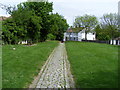
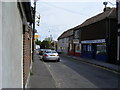
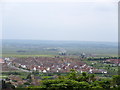
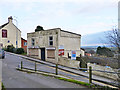
Photos of ME12 3DS


Area Information
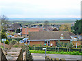
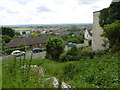
Living in ME12 3DS means being part of a small, tightly knit residential cluster in England. With a population of 1,588 spread across a low-density area of 74 people per square kilometre, the community feels intimate yet functional. This postcode is defined by its modest scale, offering a quiet alternative to larger urban centres. Daily life here is shaped by proximity to essential services and a balance between suburban comfort and practicality. The area’s character is influenced by its demographic profile: predominantly adults aged 30–64, many of whom own their homes. This suggests a stable, family-oriented environment where long-term residency is common. While the area lacks the vibrancy of a bustling city, its simplicity and accessibility make it appealing to those seeking a slower pace of life. The presence of nearby rail links and retail amenities ensures that residents can access wider opportunities without sacrificing the tranquillity of a smaller community. For those considering living in ME12 3DS, the key appeal lies in its blend of affordability, practicality, and a sense of local cohesion.
- Area Type
- Postcode
- Area Size
- Not available
- Population
- 1588
- Population Density
- 74 people/km²
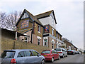
The property market in ME12 3DS is characterised by high home ownership and a focus on houses. With 80% of residents owning their homes, this area is not primarily a rental market, which may appeal to buyers seeking long-term stability. The predominance of houses over flats or apartments suggests a housing stock that prioritises space and privacy, likely catering to families or individuals who prefer standalone properties. Given the small size of the postcode, the immediate surroundings offer limited housing options, which could mean competition for available properties. Buyers should consider that the market may be more subdued than in larger towns, with fewer new developments. However, the emphasis on owner-occupation indicates a strong sense of community and investment in local properties. For those looking to purchase, the focus on houses may mean higher price points compared to rental-focused areas, but it also ensures a durable, low-turnover market.
House Prices in ME12 3DS
No properties found in this postcode.
Energy Efficiency in ME12 3DS
Residents of ME12 3DS have access to a range of nearby amenities, including retail options and rail services. The area is served by five retail outlets, including Co-op Minster and Morrisons Daily, providing essential shopping and grocery needs within practical reach. These stores cater to daily requirements, reducing the need for long commutes to larger centres. The rail network, with stations such as Queenborough and Swale, ensures connectivity to surrounding areas, supporting both work and leisure activities. While there is no mention of parks or leisure facilities in the data, the presence of retail and transport options suggests a functional lifestyle focused on convenience. The modest scale of the area means that amenities are closely grouped, fostering a sense of accessibility. For those prioritising practicality over expansive recreational spaces, ME12 3DS offers a straightforward, service-oriented environment that meets the needs of everyday living.
Amenities
Schools
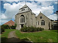
The nearest school to ME12 3DS is St Georges CofE (Aided) Primary School, which serves the local community with primary education. The school holds an Ofsted rating of ‘good’, reflecting its effectiveness in providing quality education. As the only named school in the area, it is the primary option for families with young children. The absence of secondary schools nearby means that students may need to travel further for secondary education, a factor to consider for families planning long-term stays. The presence of a single, well-rated primary school suggests that the area is suitable for those prioritising early education but may require additional planning for older children. For homebuyers, the school’s rating is a positive indicator of the local infrastructure, though the limited range of educational institutions highlights the need to assess broader transport links when evaluating the area’s suitability for families.
| Rank | School | Type | Entry gender | Ages |
|---|
Explore more schools in this area
Go to Schools tabDemographics
The community in ME12 3DS is predominantly composed of adults aged 30–64, with a median age of 47. This age range indicates a population skewed towards middle-aged individuals, many of whom are likely in their peak earning years or raising families. Home ownership is high, with 80% of residents owning their properties, suggesting a stable and long-term-oriented community. The accommodation type is primarily houses, reflecting a preference for standalone properties over flats or apartments. The predominant ethnic group is White, which aligns with broader regional trends but underscores the area’s demographic uniformity. This composition may influence local dynamics, such as the types of services and amenities prioritised. The absence of specific data on deprivation means that quality of life assessments must rely on the available figures, which point to a community that values security and permanence. For buyers, this demographic profile suggests a market where properties are likely to remain in the same hands for years, reducing turnover and fostering a sense of continuity.
Household Size
Accommodation Type
Tenure
Ethnic Group
Religion
Household Composition
Age
Household Deprivation
NS-SEC
Explore more demographic insights in this area
Go to Demographics tabPlanning
Planning Constraints
- Flood RiskPremium
- Ramsar Wetland SitesPremium
- Area of Outstanding Natural BeautyPremium
- Protected Nature ReservePremium
- Protected WoodlandPremium