Area Overview for ME12 2RP
Photos of ME12 2RP


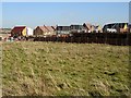


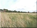

42 photos from this area
Area Information
Key information about the ME12 2RP including its size, population, and administrative classification.
- Area Type
- Postcode
- Area Size
- 2.7 hectares
- Population
- 1632
- Population Density
- 2797 people/km²
House Prices in ME12 2RP
48
Properties
£293,639
Average Sold Price
£56,000
Lowest Price
£530,000
Highest Price
Showing 48 properties
| Address | Type | Beds | Baths | Last Sale Price | Last Sale Date | |
|---|---|---|---|---|---|---|
| Thistledown, 39 Saxon Avenue, Minster On Sea, ME12 2RP | Detached | 3 | 2 | £407,500 | Dec 2024 | |
| 14 Saxon Avenue, Minster On Sea, ME12 2RP | Detached | 4 | 2 | £400,000 | Mar 2024 | |
| Greystones, Saxon Avenue, Minster On Sea, ME12 2RP | Semi-detached | 3 | 2 | £260,000 | Oct 2023 | |
| 8 Saxon Avenue, Minster On Sea, ME12 2RP | Bungalow | 3 | 1 | £406,000 | Jan 2022 | |
| Cartref, Saxon Avenue, Minster On Sea, ME12 2RP | Bungalow | - | - | £350,000 | Nov 2021 | |
| Lenton House, 31 Saxon Avenue, Minster On Sea, ME12 2RP | house | - | - | £530,000 | Nov 2021 | |
| Miglia, 14A Saxon Avenue, Minster On Sea, ME12 2RP | Bungalow | - | - | £370,000 | May 2021 | |
| Cheyne Lodge, Saxon Avenue, Minster On Sea, ME12 2RP | house | - | - | £375,000 | Mar 2021 | |
| 16 Saxon Avenue, Minster On Sea, ME12 2RP | Bungalow | - | - | £317,000 | Jan 2021 | |
| Marigold, Saxon Avenue, Minster On Sea, ME12 2RP | Bungalow | 3 | 1 | £350,000 | Nov 2020 |
Page 1 of 5
Energy Efficiency in ME12 2RP
Amenities
Schools
| Rank | School | Type | Entry gender | Ages |
|---|
Explore more schools in this area
Go to Schools tabDemographics
Household Size
Two person
most common
Accommodation Type
Houses
most common
Tenure
89
majority
Ethnic Group
White
most common
Religion
N/A
most common
Household Composition
N/A
most common
Age
47
median
Adults (30-64 years)
most common
Household Deprivation
N/A
with no deprivation
NS-SEC
30
in Lower managerial occupations
Explore more demographic insights in this area
Go to Demographics tabPlanning
Planning Constraints
- Flood RiskPremium
- Ramsar Wetland SitesPremium
- Area of Outstanding Natural BeautyPremium
- Protected Nature ReservePremium
- Protected WoodlandPremium