Area Overview for ME12 1UU
Photos of ME12 1UU
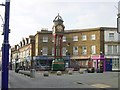


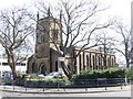
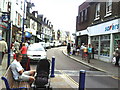
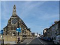

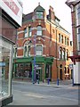
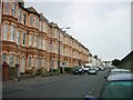
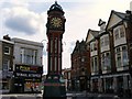
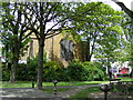
100 photos from this area
Area Information
Key information about the ME12 1UU including its size, population, and administrative classification.
- Area Type
- Postcode
- Area Size
- 5585 m²
- Population
- 1690
- Population Density
- 6358 people/km²
House Prices in ME12 1UU
24
Properties
£247,128
Average Sold Price
£125,000
Lowest Price
£360,000
Highest Price
Showing 24 properties
| Address | Type | Beds | Baths | Last Sale Price | Last Sale Date | |
|---|---|---|---|---|---|---|
| 322 High Street, Sheerness, ME12 1UU | Detached | 7 | 3 | £360,000 | Dec 2024 | |
| 296 High Street, Sheerness, ME12 1UU | Terraced | 5 | 2 | £345,000 | Nov 2024 | |
| 286 High Street, Sheerness, ME12 1UU | Terraced | 3 | 1 | £236,000 | May 2023 | |
| 284 High Street, Sheerness, ME12 1UU | house | - | - | £276,020 | Oct 2022 | |
| 308 High Street, Sheerness, ME12 1UU | house | - | - | £285,000 | Sep 2022 | |
| 316 High Street, Sheerness, ME12 1UU | Semi-detached | 2 | 2 | £210,000 | Apr 2018 | |
| 320 High Street, Sheerness, ME12 1UU | house | - | - | £125,000 | Nov 2016 | |
| 300 High Street, Sheerness, ME12 1UU | house | - | - | £140,000 | Jan 2014 | |
| 294 High Street, Sheerness, ME12 1UU | Semi-detached | 3 | 1 | - | - | |
| 312 High Street, Sheerness, ME12 1UU | house | 3 | 1 | - | - |
Page 1 of 3
Energy Efficiency in ME12 1UU
Amenities
Schools
| Rank | School | Type | Entry gender | Ages |
|---|
Explore more schools in this area
Go to Schools tabDemographics
Household Size
Family (3-5 people)
most common
Accommodation Type
Houses
most common
Tenure
53
majority
Ethnic Group
White
most common
Religion
N/A
most common
Household Composition
N/A
most common
Age
47
median
Adults (30-64 years)
most common
Household Deprivation
N/A
with no deprivation
NS-SEC
17
in Lower managerial occupations
Explore more demographic insights in this area
Go to Demographics tabPlanning
Planning Constraints
- Flood RiskPremium
- Ramsar Wetland SitesPremium
- Area of Outstanding Natural BeautyPremium
- Protected Nature ReservePremium
- Protected WoodlandPremium