Area Overview for ME11 5LX
Photos of ME11 5LX
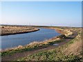

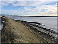
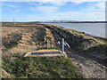
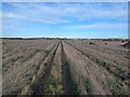
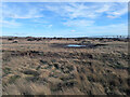
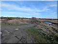
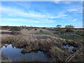
23 photos from this area
Area Information
Key information about the ME11 5LX including its size, population, and administrative classification.
- Area Type
- Postcode
- Area Size
- 5.7 hectares
- Population
- 1844
- Population Density
- 433 people/km²
House Prices in ME11 5LX
41
Properties
£132,653
Average Sold Price
£33,000
Lowest Price
£210,000
Highest Price
Showing 41 properties
| Address | Type | Beds | Baths | Last Sale Price | Last Sale Date | |
|---|---|---|---|---|---|---|
| 72 Manor Road, Queenborough, ME11 5LX | house | - | - | £210,000 | Mar 2025 | |
| 97 Manor Road, Queenborough, ME11 5LX | Terraced | 3 | 1 | £210,000 | Dec 2023 | |
| 76 Manor Road, Queenborough, ME11 5LX | house | - | - | £180,000 | May 2022 | |
| 101 Manor Road, Queenborough, ME11 5LX | Terraced | 3 | 1 | £170,000 | Apr 2018 | |
| 95 Manor Road, Queenborough, ME11 5LX | Terraced | 3 | - | £162,000 | Dec 2017 | |
| 78 Manor Road, Queenborough, ME11 5LX | house | - | - | £140,000 | Oct 2014 | |
| 50 Manor Road, Queenborough, ME11 5LX | house | 3 | - | £130,000 | Nov 2013 | |
| 73 Manor Road, Queenborough, ME11 5LX | house | 3 | - | £118,000 | May 2012 | |
| 119 Manor Road, Queenborough, ME11 5LX | house | 3 | - | £88,000 | Dec 2011 | |
| 115 Manor Road, Queenborough, ME11 5LX | house | 3 | - | £122,995 | Apr 2007 |
Page 1 of 5
Energy Efficiency in ME11 5LX
Amenities
Schools
| Rank | School | Type | Entry gender | Ages |
|---|
Explore more schools in this area
Go to Schools tabDemographics
Household Size
Family (3-5 people)
most common
Accommodation Type
Houses
most common
Tenure
49
majority
Ethnic Group
White
most common
Religion
N/A
most common
Household Composition
N/A
most common
Age
47
median
Adults (30-64 years)
most common
Household Deprivation
N/A
with no deprivation
NS-SEC
17
in Lower managerial occupations
Explore more demographic insights in this area
Go to Demographics tabPlanning
Planning Constraints
- Flood RiskPremium
- Ramsar Wetland SitesPremium
- Area of Outstanding Natural BeautyPremium
- Protected Nature ReservePremium
- Protected WoodlandPremium