Area Overview for ME11 5HY
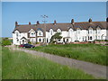
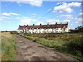
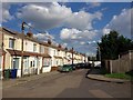
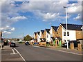
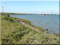
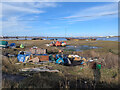
Photos of ME11 5HY


Area Information
ME11 5HY is a small, tightly knit residential area in England, home to 1844 people spread across a compact postcode cluster. With a population density of 433 people per square kilometre, it is a modest yet well-defined community. The area’s character is shaped by its proximity to practical amenities and transport links, making it accessible for daily life. Residents benefit from nearby railway stations, including Queenborough and Swale, which connect to broader networks. The demographic profile suggests a mature population, with a median age of 47 and a majority of adults aged 30–64. This suggests a mix of established families and professionals, drawn to the area’s quiet residential appeal and proximity to essential services. While the area lacks sprawling green spaces or major landmarks, its compact nature ensures a sense of familiarity and convenience. For those seeking a balanced lifestyle with practical infrastructure, ME11 5HY offers a straightforward, no-frills environment.
- Area Type
- Postcode
- Area Size
- Not available
- Population
- 1844
- Population Density
- 433 people/km²
The property market in ME11 5HY is characterised by a 49% home ownership rate, indicating that nearly half of the housing stock is rented. This suggests a rental market that caters to both long-term tenants and those seeking temporary accommodation. The predominant accommodation type is houses, which implies a focus on family homes or larger properties. Given the area’s small size, the housing stock is limited, and buyers should consider the proximity to nearby amenities such as retail outlets and railway stations. The mix of owner-occupied and rental properties may influence property values, with demand likely driven by practicality rather than luxury. For buyers, the compact nature of the area means that properties are closely clustered, offering convenience but limited scope for expansion.
House Prices in ME11 5HY
No properties found in this postcode.
Energy Efficiency in ME11 5HY
The lifestyle in ME11 5HY is shaped by its proximity to essential amenities. Residents have access to five railway stations, including Queenborough and Swale, which provide straightforward links to nearby towns and cities. Retail options are varied, with stores such as Co-op Queensborough, Iceland Queenborough, and Morrisons Rushenden offering grocery and household needs. While the area lacks expansive parks or leisure facilities, its practical layout ensures that daily errands and travel are efficient. The compact nature of the postcode means that amenities are closely clustered, reducing the need for long journeys. This focus on accessibility and functionality defines the area’s character, appealing to those who prioritise convenience over sprawling recreational spaces.
Amenities
Schools
The nearest school to ME11 5HY is the Threshold Learning Centre, an independent institution. This single school option highlights a limited range of educational choices for families in the area. As an independent school, it may cater to specific educational philosophies or specialisms, but the absence of state schools or additional institutions means residents must look beyond the immediate postcode for broader options. The lack of diversity in school types could be a consideration for families prioritising a range of educational approaches. However, the presence of a dedicated independent school may appeal to those seeking structured, fee-based education.
| Rank | School | Type | Entry gender | Ages |
|---|
Explore more schools in this area
Go to Schools tabDemographics
The community in ME11 5HY is predominantly composed of adults aged 30–64, with a median age of 47. This indicates a stable, middle-aged population, likely consisting of families and long-term residents. Home ownership rates stand at 49%, suggesting a mix of owner-occupied properties and rental units. The accommodation type is primarily houses, reflecting a residential area suited to families or individuals preferring standalone homes. The predominant ethnic group is White, with no specific data provided on other demographics. The absence of detailed diversity statistics means the area’s cultural composition remains largely unexplored in this context. The age profile and home ownership figures suggest a community focused on stability rather than rapid change, with residents potentially prioritising proximity to services and transport over urban amenities.
Household Size
Accommodation Type
Tenure
Ethnic Group
Religion
Household Composition
Age
Household Deprivation
NS-SEC
Explore more demographic insights in this area
Go to Demographics tabPlanning
Planning Constraints
- Flood RiskPremium
- Ramsar Wetland SitesPremium
- Area of Outstanding Natural BeautyPremium
- Protected Nature ReservePremium
- Protected WoodlandPremium