Area Overview for ME11 5HT
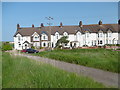
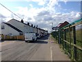
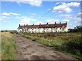
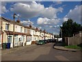
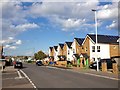
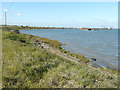
Photos of ME11 5HT


Area Information
Living in ME11 5ST means inhabiting a small, tightly knit residential cluster in England, where 1,844 people reside across a compact area. The population density of 433 people per square kilometre reflects a community that is neither sprawling nor overly congested, offering a balance between privacy and proximity. This postcode area sits at the intersection of practicality and accessibility, with rail links to Queenborough, Swale, and Sheerness stations within reach. Daily life here is shaped by its proximity to retail hubs like Co-op Queensborough and Morrisons Rushenden, ensuring essentials are never far. While the area lacks large-scale amenities, its small size fosters a sense of familiarity, with residents likely to know their neighbours. The demographic profile—predominantly adults aged 30–64—suggests a community focused on stability, with homes primarily occupied by owners and renters in a modestly sized housing stock. For those seeking a quiet, manageable environment with straightforward access to transport and shopping, ME11 5ST offers a straightforward, no-frills lifestyle.
- Area Type
- Postcode
- Area Size
- Not available
- Population
- 1844
- Population Density
- 433 people/km²
The property market in ME11 5ST is characterised by a mix of owner-occupied and rented homes, with 49% of properties owned by residents. The accommodation type is primarily houses, which suggests a focus on single-family dwellings rather than apartments or terraced housing. This makes the area more suited to families or individuals prioritising space over density. However, the small size of the postcode area means the housing stock is limited, with few options for buyers seeking a wide range of properties. The predominance of houses may also indicate a slower turnover rate, as larger homes are less frequently bought and sold. For those considering ME11 5ST, the market is likely to be competitive for available properties, but the compact nature of the area means proximity to amenities and transport is a key advantage. Buyers should also consider the balance between home ownership and rental availability, as the lower ownership rate may reflect a reliance on local landlords or long-term leases.
House Prices in ME11 5HT
No properties found in this postcode.
Energy Efficiency in ME11 5HT
Daily life in ME11 5ST is shaped by its proximity to essential retail and transport hubs. The five nearby retail venues, including Co-op Queensborough and Morrisons Rushenden, provide access to groceries, household goods, and other necessities within walking or short driving distance. These shops cater to a practical, no-frills lifestyle, with minimal need for long trips to larger centres. The rail network, with stations such as Queenborough and Swale, offers frequent connections to nearby towns, enabling residents to commute or explore beyond the immediate area. While the data does not specify parks or leisure facilities, the absence of planning constraints like protected woodlands or AONB designations suggests open spaces may be limited. Nonetheless, the area’s compact size ensures that amenities are clustered closely, reducing the time and effort required to access services. For those prioritising convenience over expansive leisure options, ME11 5ST offers a straightforward, functional lifestyle.
Amenities
Schools
The nearest school to ME11 5ST is Threshold Learning Centre, an independent institution. This type of school typically offers smaller class sizes and specialised curricula, though no Ofsted rating is provided in the data. The absence of state schools in the immediate vicinity means families may need to look beyond the postcode area for public education options. The presence of a single independent school suggests that the community may cater to households prioritising private education, though it also highlights a potential limitation for families seeking diverse schooling choices. Parents should consider the catchment areas and transportation links to other schools in the region, as the local offering is limited to one institution. For those valuing independent education, Threshold Learning Centre could be a significant draw, but it is essential to weigh this against the broader availability of state-run schools nearby.
| Rank | School | Type | Entry gender | Ages |
|---|
Explore more schools in this area
Go to Schools tabDemographics
The community in ME11 5ST is defined by its mature age profile, with a median age of 47 and the majority of residents falling within the 30–64 age range. This suggests a population largely composed of established professionals, families, and retirees, with fewer young dependents. Home ownership here is relatively low at 49%, indicating that nearly half of residents rent their homes, possibly due to the area’s modest housing stock. The accommodation type is predominantly houses, which aligns with the age demographic’s preference for family-friendly living spaces. The predominant ethnic group is White, though no specific data on diversity or deprivation is provided. The age range and home ownership figures imply a community that values stability over rapid change, with a focus on long-term residency rather than transient populations. This profile may appeal to buyers seeking a settled, low-maintenance environment with a clear sense of local identity.
Household Size
Accommodation Type
Tenure
Ethnic Group
Religion
Household Composition
Age
Household Deprivation
NS-SEC
Explore more demographic insights in this area
Go to Demographics tabPlanning
Planning Constraints
- Flood RiskPremium
- Ramsar Wetland SitesPremium
- Area of Outstanding Natural BeautyPremium
- Protected Nature ReservePremium
- Protected WoodlandPremium