Area Overview for ME11 5HD
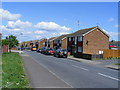
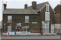
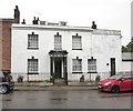
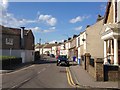
Photos of ME11 5HD


Area Information
Living in ME11 5HD means being part of a small, tightly knit residential cluster in England. With a population of 1,844 and a density of 433 people per square kilometre, this area is compact yet functional. It is not a sprawling suburb but a defined postcode area with a focus on housing. The community here is predominantly middle-aged, with the median age at 47 and the majority of residents falling within the 30–64 age range. This suggests a stable population with established households rather than a transient mix of younger or older demographics. Daily life is shaped by proximity to local amenities, including five nearby railway stations and a selection of retail outlets. While the area lacks large-scale infrastructure, its small size ensures that essential services are within practical reach. For those seeking a quiet, low-density environment with a balance of residential comfort and accessibility, ME11 5HD offers a straightforward, no-frills living experience. The absence of major planning constraints or environmental designations means development is not restricted, though the area remains unremarkable in terms of natural or cultural landmarks.
- Area Type
- Postcode
- Area Size
- Not available
- Population
- 1844
- Population Density
- 433 people/km²
The property market in ME11 5HD is characterised by a mix of owner-occupied homes and rental properties. With 49% of residents owning their homes, the area is not dominated by a single market segment, though the presence of houses as the primary accommodation type suggests a focus on family-sized properties. This contrasts with areas where flats or apartments predominate, indicating a preference for more spacious, traditional housing. The small size of the postcode area means the housing stock is limited, and buyers should consider the immediate surroundings for additional options. The lack of planning constraints or environmental designations allows for development flexibility, though the area’s modest scale means it is unlikely to attract large-scale investment. For those seeking a home with a balance of privacy and accessibility, ME11 5HD offers a straightforward market, but the limited inventory may require a broader search beyond the immediate postcode.
House Prices in ME11 5HD
No properties found in this postcode.
Energy Efficiency in ME11 5HD
Residents of ME11 5HD have access to a range of local amenities within practical reach. The area includes five retail outlets, such as Co-op Queensborough, Iceland Queenborough, and Budgens Queenborough, providing essential shopping options for groceries and household items. These stores cater to daily needs without requiring long commutes. The proximity to railway stations enhances mobility, allowing residents to travel to larger towns or cities for more specialised services. While the area lacks large parks or entertainment venues, the presence of multiple retail points and transport links suggests a functional, community-focused lifestyle. The small scale of the area means amenities are concentrated, making them easily accessible. This setup is ideal for those prioritising convenience over expansive leisure options, though the character of the area is defined by its practicality rather than its vibrancy.
Amenities
Schools
The nearest school to ME11 5HD is the Threshold Learning Centre, an independent institution. This type of school typically operates outside the state education system, offering a distinct curriculum and governance model. The absence of other schools in the data means the area is not served by a range of educational options, though the presence of an independent school may appeal to families seeking alternative educational pathways. Independent schools often have selective admissions and higher fees, which could influence the area’s demographic profile. For families prioritising state education, the lack of listed schools suggests a need to look beyond ME11 5HD for nearby options. The single school listed reflects the area’s small size, but it does provide a specific educational resource for residents.
| Rank | School | Type | Entry gender | Ages |
|---|
Explore more schools in this area
Go to Schools tabDemographics
The community in ME11 5HD is defined by its age profile and home ownership rates. With a median age of 47, the area is home to a largely middle-aged population, with the most common age range being adults aged 30–64. This suggests a mature demographic with long-term residency patterns. Home ownership is at 49%, meaning just under half of residents own their homes, while the remaining 51% are likely to be renters. The accommodation type is predominantly houses, indicating a lack of high-rise or apartment blocks. The predominant ethnic group is White, which aligns with broader regional trends but offers limited insight into the area’s cultural diversity. The absence of specific data on deprivation or income levels means quality of life cannot be assessed in detail, though the moderate population density and stable age distribution suggest a balanced, low-pressure environment. This area is not defined by extremes—neither highly deprived nor affluent—but by its quiet, functional character.
Household Size
Accommodation Type
Tenure
Ethnic Group
Religion
Household Composition
Age
Household Deprivation
NS-SEC
Explore more demographic insights in this area
Go to Demographics tabPlanning
Planning Constraints
- Flood RiskPremium
- Ramsar Wetland SitesPremium
- Area of Outstanding Natural BeautyPremium
- Protected Nature ReservePremium
- Protected WoodlandPremium