Area Overview for ME11 5AW
Photos of ME11 5AW
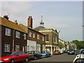
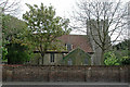
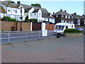
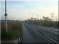
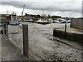
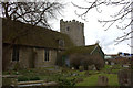
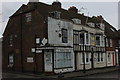
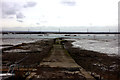

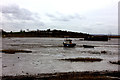
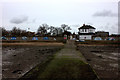

99 photos from this area
Area Information
Key information about the ME11 5AW including its size, population, and administrative classification.
- Area Type
- Postcode
- Area Size
- 19.5 hectares
- Population
- 1694
- Population Density
- 617 people/km²
House Prices in ME11 5AW
46
Properties
£159,833
Average Sold Price
£52,000
Lowest Price
£270,000
Highest Price
Showing 46 properties
| Address | Type | Beds | Baths | Last Sale Price | Last Sale Date | |
|---|---|---|---|---|---|---|
| 40 Foxley Road, Queenborough, ME11 5AW | Bungalow | 2 | 2 | £270,000 | Nov 2025 | |
| 32 Foxley Road, Queenborough, ME11 5AW | Bungalow | 2 | 1 | £200,000 | Aug 2024 | |
| 31 Foxley Road, Queenborough, ME11 5AW | Bungalow | 2 | 1 | £240,000 | Jan 2024 | |
| 43 Foxley Road, Queenborough, ME11 5AW | Semi-detached | 3 | 1 | £265,000 | Aug 2020 | |
| 12 Foxley Road, Queenborough, ME11 5AW | Semi-detached | 3 | 1 | £255,000 | Jul 2020 | |
| 41 Foxley Road, Queenborough, ME11 5AW | Bungalow | 3 | 1 | £235,000 | May 2019 | |
| 8 Foxley Road, Queenborough, ME11 5AW | house | - | - | £225,000 | Jul 2016 | |
| 35 Foxley Road, Queenborough, ME11 5AW | Semi-detached | - | - | £153,000 | Sep 2014 | |
| 36 Foxley Road, Queenborough, ME11 5AW | Bungalow | 2 | - | £140,000 | Dec 2010 | |
| 26 Foxley Road, Queenborough, ME11 5AW | house | 2 | - | £150,000 | Aug 2007 |
Page 1 of 5
Energy Efficiency in ME11 5AW
Amenities
Schools
| Rank | School | Type | Entry gender | Ages |
|---|
Explore more schools in this area
Go to Schools tabDemographics
Household Size
Family (3-5 people)
most common
Accommodation Type
Houses
most common
Tenure
61
majority
Ethnic Group
White
most common
Religion
N/A
most common
Household Composition
N/A
most common
Age
47
median
Adults (30-64 years)
most common
Household Deprivation
N/A
with no deprivation
NS-SEC
19
in Lower managerial occupations
Explore more demographic insights in this area
Go to Demographics tabPlanning
Planning Constraints
- Flood RiskPremium
- Ramsar Wetland SitesPremium
- Area of Outstanding Natural BeautyPremium
- Protected Nature ReservePremium
- Protected WoodlandPremium