Area Overview for ME10 4UW
Photos of ME10 4UW
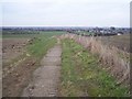
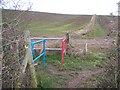
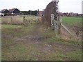

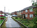
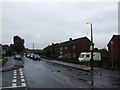
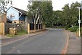

8 photos from this area
Area Information
Key information about the ME10 4UW including its size, population, and administrative classification.
- Area Type
- Postcode
- Area Size
- 1.4 hectares
- Population
- 1701
- Population Density
- 4867 people/km²
House Prices in ME10 4UW
34
Properties
£225,600
Average Sold Price
£34,000
Lowest Price
£370,000
Highest Price
Showing 34 properties
| Address | Type | Beds | Baths | Last Sale Price | Last Sale Date | |
|---|---|---|---|---|---|---|
| 151 Peregrine Drive, Sittingbourne, ME10 4UW | Detached | 3 | 2 | £320,000 | Mar 2025 | |
| 129 Peregrine Drive, Sittingbourne, ME10 4UW | Detached | 4 | 1 | £355,000 | Oct 2024 | |
| 128 Peregrine Drive, Sittingbourne, ME10 4UW | Semi-detached | 4 | - | £357,500 | Aug 2021 | |
| 138 Peregrine Drive, Sittingbourne, ME10 4UW | Detached | 4 | 1 | £320,000 | Jun 2021 | |
| 142 Peregrine Drive, Sittingbourne, ME10 4UW | Terraced | 3 | 1 | £275,000 | Apr 2021 | |
| 145 Peregrine Drive, Sittingbourne, ME10 4UW | Detached | 4 | 1 | £310,000 | Dec 2019 | |
| 157 Peregrine Drive, Sittingbourne, ME10 4UW | Detached | 4 | 1 | £370,000 | Aug 2018 | |
| 155 Peregrine Drive, Sittingbourne, ME10 4UW | Detached | 3 | 1 | £300,000 | Mar 2018 | |
| 130 Peregrine Drive, Sittingbourne, ME10 4UW | house | 4 | 1 | £267,000 | Mar 2016 | |
| 148 Peregrine Drive, Sittingbourne, ME10 4UW | house | 3 | - | £175,000 | Aug 2014 |
Page 1 of 4
Energy Efficiency in ME10 4UW
Amenities
Schools
| Rank | School | Type | Entry gender | Ages |
|---|
Explore more schools in this area
Go to Schools tabDemographics
Household Size
Two person
most common
Accommodation Type
Houses
most common
Tenure
66
majority
Ethnic Group
White
most common
Religion
N/A
most common
Household Composition
N/A
most common
Age
47
median
Adults (30-64 years)
most common
Household Deprivation
N/A
with no deprivation
NS-SEC
28
in Lower managerial occupations
Explore more demographic insights in this area
Go to Demographics tabPlanning
Planning Constraints
- Flood RiskPremium
- Ramsar Wetland SitesPremium
- Area of Outstanding Natural BeautyPremium
- Protected Nature ReservePremium
- Protected WoodlandPremium