Area Overview for ME10 4SZ
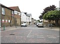
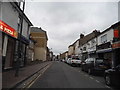
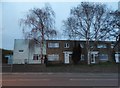
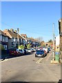
Photos of ME10 4SZ


Area Information
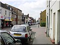
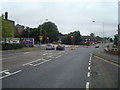
ME10 4SZ is a small residential cluster in England, home to 2033 people. It is a compact area where daily life is shaped by its proximity to nearby towns and practical amenities. The community here is predominantly composed of adults aged 30–64, reflecting a mature, stable demographic. The area’s character is defined by its mix of traditional housing and quiet neighbourhoods, with no large-scale developments or commercial hubs. Residents benefit from being close to essential services, including retail and rail links, while maintaining a low-key, residential feel. The postcode’s small size means it is not a sprawling suburb but a tightly knit cluster of homes. For those seeking a place with a balance of convenience and tranquillity, ME10 4SZ offers a straightforward, no-frills living experience. Its appeal lies in its simplicity: no grand estates, no towering buildings, just homes and the infrastructure needed for everyday living. The area’s compact nature ensures that residents are never far from key services, making it practical for families and individuals alike.
- Area Type
- Postcode
- Area Size
- Not available
- Population
- 2033
- Population Density
- 8862 people/km²
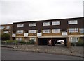
ME10 4SZ is primarily a housing area where 55% of properties are owner-occupied, with the remaining 45% likely rented. The accommodation type is predominantly houses, which is unusual for areas with higher apartment or flat density. This suggests a focus on single-family homes, which may cater to families or individuals seeking more space. The small size of the postcode means the housing stock is limited, and the immediate surroundings may offer more options. For buyers, this implies a market where properties are likely to be more traditional in design and layout. The lower home ownership rate could indicate a rental market component, but the overall emphasis on houses suggests a preference for private, detached living. Prospective buyers should consider that the area’s compact nature may limit availability, requiring a focus on nearby suburbs for more choices.
House Prices in ME10 4SZ
No properties found in this postcode.
Energy Efficiency in ME10 4SZ
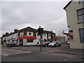
Residents of ME10 4SZ have access to nearby retail options, including Tesco Canterbury, Aldi Sittingbourne, and Co-op Murston, which provide essential shopping and groceries. The area’s rail stations—Sittingbourne, Kemsley, and Teynham—offer connections to broader networks, facilitating travel to larger towns or cities for additional amenities. While the data does not mention parks or leisure facilities, the presence of retail and rail links suggests a lifestyle focused on convenience and practicality. The compact nature of the area means that daily needs are within walking or short driving distance, reducing the need for long commutes. The mix of shops and transport options supports a self-contained lifestyle, though residents may need to travel further for more specialised services or entertainment. Overall, the area is suited to those prioritising accessibility over expansive leisure opportunities.
Amenities
Schools
Near ME10 4SZ are three schools: Canterbury Road Primary School, a state-funded primary school with a good Ofsted rating; Threshold Learning Centre, an independent school; and VTC Independent School, also independent with a good Ofsted rating. The mix of state and independent options provides families with choices, though the area’s small size means these schools are likely the closest options. Canterbury Road Primary School’s good rating indicates a reliable foundation for younger children, while the independent schools may cater to those seeking alternative educational approaches. However, the lack of secondary schools in the immediate vicinity could require families to consider commuting to nearby towns. The presence of two independent schools with good ratings suggests a demand for private education, but the overall school landscape remains modest in scale.
| Rank | School | Type | Entry gender | Ages |
|---|
Explore more schools in this area
Go to Schools tabDemographics
The population of ME10 4SZ is 2033, with a median age of 47. The most common age range is adults between 30 and 64, indicating a community that is largely settled and established. Home ownership here is 55%, suggesting a mix of owner-occupied properties and rental homes. The predominant accommodation type is houses, which aligns with the area’s small, residential character. The majority of residents identify as White, reflecting the broader demographic patterns of the region. While specific data on deprivation or diversity is not provided, the age profile and home ownership figures suggest a relatively stable, middle-aged population with a focus on long-term residency. The absence of younger households or high rental rates implies a community that prioritises family homes and stability over transient living. This profile may appeal to buyers seeking a quiet, mature environment with minimal turnover.
Household Size
Accommodation Type
Tenure
Ethnic Group
Religion
Household Composition
Age
Household Deprivation
NS-SEC
Explore more demographic insights in this area
Go to Demographics tabPlanning
Planning Constraints
- Flood RiskPremium
- Ramsar Wetland SitesPremium
- Area of Outstanding Natural BeautyPremium
- Protected Nature ReservePremium
- Protected WoodlandPremium