Area Overview for ME10 4AL
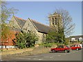
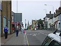
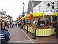
Photos of ME10 4AL


Area Information
Living in ME10 4AL offers a compact, tightly knit residential experience within a small cluster of homes. The area covers just 215 square metres, yet it supports a population of 2,066 people, resulting in a high population density. This density reflects a mature community, with a median age of 47 and a strong presence of adults aged 30–64. Daily life here is shaped by proximity to essential services, including five nearby railway stations and a range of retail outlets. The area’s mix of primary schools, including South Avenue Primary School with a good Ofsted rating, suggests a focus on family living. While the population is predominantly White, the data does not specify further diversity metrics. ME10 4AL is not a sprawling suburb but a defined postcode area where convenience and community interdependence are key. Residents benefit from strong broadband connectivity and access to local amenities, though safety considerations, particularly crime risk, require attention. This is a place where practicality meets a lived-in character, ideal for those prioritising accessibility over expansive space.
- Area Type
- Postcode
- Area Size
- 215 m²
- Population
- 2066
- Population Density
- 4421 people/km²
The property market in ME10 4AL is defined by a 48% home ownership rate, with houses forming the predominant accommodation type. This suggests a focus on owner-occupied properties rather than a rental market, though the relatively low home ownership percentage indicates a significant proportion of residents may rent. Given the area’s small size and high population density, the housing stock is limited to a compact cluster of homes. For buyers, this means a constrained selection of properties, likely concentrated in traditional house formats. The small area’s immediate surroundings may offer limited expansion, making ME10 4AL a niche market for those prioritising proximity to amenities over property choice. The lack of flats or apartments further narrows options, though the presence of schools and transport links could offset this for families. Buyers should consider the area’s compact nature and the potential for limited future development.
House Prices in ME10 4AL
No properties found in this postcode.
Energy Efficiency in ME10 4AL
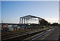
The lifestyle in ME10 4AL is shaped by its proximity to retail and transport hubs. Nearby supermarkets like Lidl Central and Sainsburys Sittingbourne provide easy access to groceries and daily essentials, reducing the need for long trips. The five railway stations, including Sittingbourne and Kemsley, offer connections to broader networks, facilitating commuting or weekend excursions. While the data does not mention parks or leisure facilities, the presence of multiple schools and retail outlets suggests a focus on practicality over expansive recreational spaces. The area’s compact nature means amenities are closely clustered, fostering a sense of convenience. However, residents may need to venture further for specialist services or green spaces. The mix of retail and transport options supports a functional, community-oriented lifestyle.
Amenities
Schools
ME10 4AL is served by several schools, including South Avenue Infant School and South Avenue Junior School, both primary institutions. The Nativity School is an independent option, while another South Avenue Junior School operates as an academy. Notably, South Avenue Primary School holds a good Ofsted rating, indicating a reliable standard of education. This mix of school types—state primary, academy, and independent—offers families flexibility. The concentration of primary schools suggests a focus on local education, reducing the need for long commutes. However, the absence of secondary schools in the data means parents may need to look beyond the immediate area for high school options. The presence of multiple primary schools could ease pressure on individual institutions, but the overall educational landscape remains centered on foundational learning.
| Rank | School | Type | Entry gender | Ages |
|---|
Explore more schools in this area
Go to Schools tabDemographics
The community in ME10 4AL is predominantly composed of adults aged 30–64, with a median age of 47. This suggests a stable, middle-aged population, likely with established careers and families. Home ownership stands at 48%, indicating a balanced mix of owner-occupied properties and rental homes. The area is characterised by houses rather than flats, reflecting a traditional housing stock. The predominant ethnic group is White, though no further breakdown of diversity is provided. With a population of 2,066 in a small area, the density is exceptionally high—9.5 million people per square kilometre—implying a tightly packed residential environment. This density may influence social dynamics, fostering a sense of community but also potentially straining local infrastructure. The data does not include deprivation metrics, but the high home ownership rate and presence of schools suggest a generally stable socioeconomic profile.
Household Size
Accommodation Type
Tenure
Ethnic Group
Religion
Household Composition
Age
Household Deprivation
NS-SEC
Explore more demographic insights in this area
Go to Demographics tabPlanning
Planning Constraints
- Flood RiskPremium
- Ramsar Wetland SitesPremium
- Area of Outstanding Natural BeautyPremium
- Protected Nature ReservePremium
- Protected WoodlandPremium