Area Overview for ME10 3SF
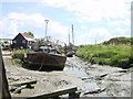
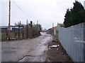
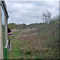
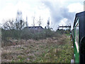
Photos of ME10 3SF


Area Information
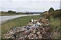
Living in ME10 3SF means inhabiting a small, tightly knit residential cluster in England’s southeast. With a population of 1,557, the area is compact, offering a quiet, low-density lifestyle. Daily life here is shaped by proximity to nearby towns and a mix of local amenities. The postcode sits near key transport links, including multiple railway stations, which connect residents to broader regional networks. While the area is small, it balances practicality with access to essential services. The demographic profile suggests a mature community, with adults aged 30–64 forming the majority. For those seeking a place with minimal environmental constraints, ME10 3SF has low flood risk and no protected natural sites, though safety concerns persist. This is a place where simplicity and accessibility define the rhythm of life, though buyers must weigh its pros and cons carefully.
- Area Type
- Postcode
- Area Size
- Not available
- Population
- 1557
- Population Density
- 1751 people/km²
The property market in ME10 3SF is characterised by a low home ownership rate of 29%, suggesting a rental-driven economy rather than owner-occupation. The accommodation type is predominantly houses, which is unusual for areas with higher rental demand. This mix implies a limited stock of owner-occupied properties, possibly due to the area’s small size or historical development patterns. For buyers, this means competition may be low, but the market is not geared toward investment or long-term ownership. The focus on houses also indicates a lack of high-density housing, which could limit options for those seeking flats or apartments. Buyers should consider the rental market’s dynamics and the area’s suitability for those prioritising property ownership over tenancy.
House Prices in ME10 3SF
No properties found in this postcode.
Energy Efficiency in ME10 3SF
Residents of ME10 3SF have access to nearby retail options, including Co-op Murston, Asda Sittingbourne, and Aldi Sittingbourne, which provide essential shopping needs. The rail network offers connections to Sittingbourne, Kemsley, and Teynham stations, facilitating travel to larger towns. While the area lacks detailed information on parks or leisure facilities, the absence of protected natural sites suggests minimal restrictions on development. The lifestyle here is defined by practicality, with daily life revolving around local shops and train services. The compact nature of the area means amenities are concentrated in nearby towns, requiring residents to travel short distances for dining, entertainment, or recreation.
Amenities
Schools
The schools nearest to ME10 3SF include Murston Infant School, a primary institution, and KITE College, a special needs school. No Ofsted ratings are provided in the data, so their performance cannot be assessed here. The presence of both a primary school and a special needs institution suggests a mix of educational provision, though the absence of secondary schools may require families to travel further for comprehensive education. For parents, this means proximity to early years education and specialist support, but the lack of a full school spectrum could be a drawback. The schools listed reflect a focus on foundational and tailored learning, but buyers should investigate additional educational options in the surrounding area.
| Rank | School | Type | Entry gender | Ages |
|---|
Explore more schools in this area
Go to Schools tabDemographics
The community in ME10 3SF is predominantly composed of adults aged 30–64, with a median age of 47. Home ownership here is notably low at 29%, indicating a rental market dominated by private tenancies. The accommodation type is primarily houses, reflecting a preference for single-family units. The predominant ethnic group is White, with no specific data on other demographics provided. The low home ownership rate suggests a transient population or reliance on rental housing. While the area lacks detailed deprivation data, the high crime risk score of 1/100 raises questions about safety and quality of life. These factors, combined with the age profile, paint a picture of a mature, possibly working-age population living in a practical but not affluent environment.
Household Size
Accommodation Type
Tenure
Ethnic Group
Religion
Household Composition
Age
Household Deprivation
NS-SEC
Explore more demographic insights in this area
Go to Demographics tabPlanning
Planning Constraints
- Flood RiskPremium
- Ramsar Wetland SitesPremium
- Area of Outstanding Natural BeautyPremium
- Protected Nature ReservePremium
- Protected WoodlandPremium