Area Overview for ME10 3PB
Photos of ME10 3PB
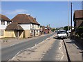
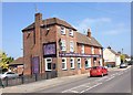
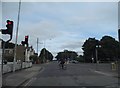
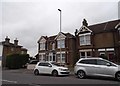
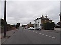
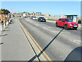
36 photos from this area
Area Information
Key information about the ME10 3PB including its size, population, and administrative classification.
- Area Type
- Postcode
- Area Size
- 1.3 hectares
- Population
- 2717
- Population Density
- 1080 people/km²
House Prices in ME10 3PB
49
Properties
£142,662
Average Sold Price
£48,500
Lowest Price
£260,000
Highest Price
Showing 49 properties
| Address | Type | Beds | Baths | Last Sale Price | Last Sale Date | |
|---|---|---|---|---|---|---|
| 72 All Saints Road, Sittingbourne, ME10 3PB | Terraced | 3 | 1 | £260,000 | May 2025 | |
| 9 All Saints Road, Sittingbourne, ME10 3PB | Terraced | 2 | 1 | £220,000 | May 2025 | |
| 60 All Saints Road, Sittingbourne, ME10 3PB | Terraced | 3 | 1 | £240,000 | Jul 2023 | |
| 5 All Saints Road, Sittingbourne, ME10 3PB | Semi-detached | 3 | 1 | £180,000 | Jun 2023 | |
| 52 All Saints Road, Sittingbourne, ME10 3PB | Terraced | 3 | 1 | £230,000 | Dec 2021 | |
| 44 All Saints Road, Sittingbourne, ME10 3PB | Semi-detached | 3 | 1 | £231,000 | Sep 2021 | |
| 82 All Saints Road, Sittingbourne, ME10 3PB | Terraced | 2 | 1 | £215,000 | Aug 2020 | |
| 24 All Saints Road, Sittingbourne, ME10 3PB | Terraced | 3 | 1 | £205,500 | Aug 2020 | |
| 1 All Saints Road, Sittingbourne, ME10 3PB | Terraced | 3 | 1 | £229,000 | Oct 2019 | |
| 34 All Saints Road, Sittingbourne, ME10 3PB | Terraced | 3 | 3 | £178,000 | Sep 2019 |
Page 1 of 5
Energy Efficiency in ME10 3PB
Amenities
Schools
| Rank | School | Type | Entry gender | Ages |
|---|
Explore more schools in this area
Go to Schools tabDemographics
Household Size
Family (3-5 people)
most common
Accommodation Type
Houses
most common
Tenure
64
majority
Ethnic Group
White
most common
Religion
N/A
most common
Household Composition
N/A
most common
Age
47
median
Adults (30-64 years)
most common
Household Deprivation
N/A
with no deprivation
NS-SEC
27
in Lower managerial occupations
Explore more demographic insights in this area
Go to Demographics tabPlanning
Planning Constraints
- Flood RiskPremium
- Ramsar Wetland SitesPremium
- Area of Outstanding Natural BeautyPremium
- Protected Nature ReservePremium
- Protected WoodlandPremium