Area Overview for ME10 3HE
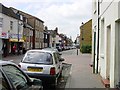
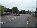
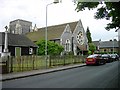
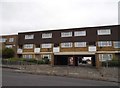
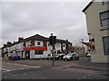
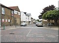
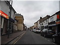
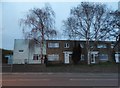
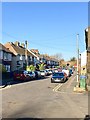
Photos of ME10 3HE


Area Information
Living in ME10 3HE means being part of a small, tightly knit residential cluster in England, home to 1,557 people. This area is characterised by its quiet, low-density housing stock, with a median age of 47 and a population skewed toward adults aged 30–64. Daily life here is shaped by proximity to essential services, including five retail outlets such as Co-op Murston and Tesco Canterbury, and easy access to rail networks like Sittingbourne and Teynham stations. The area lacks large-scale amenities but offers a sense of community, with schools like Murston Infant School and KITE College serving local families. While the postcode’s small size means limited housing options, it provides a straightforward lifestyle for those prioritising convenience over urban vibrancy. The absence of major planning constraints, such as AONB or protected woodlands, suggests a practical, unencumbered environment for residents. However, the area’s safety profile is mixed, with a critical crime risk score of 1/100, which prospective buyers should consider. For those seeking a simple, compact living space with direct access to transport and basic amenities, ME10 3HE offers a functional, if unexciting, backdrop.
- Area Type
- Postcode
- Area Size
- Not available
- Population
- 1557
- Population Density
- 1751 people/km²
The property market in ME10 3HE is defined by its low home ownership rate of 29%, suggesting that the area is more rental-focused than owner-occupied. The predominant accommodation type is houses, which may appeal to families or individuals seeking private living spaces. However, the small population and limited housing stock mean the market is unlikely to be competitive, with fewer options for buyers. This dynamic could benefit those seeking affordable properties, but it also means the area’s housing supply is constrained. For buyers, the low home ownership rate may indicate a higher proportion of short-term rentals or properties managed by landlords, which could affect long-term investment potential. The lack of large-scale development or planning constraints, such as AONB designations, suggests that property values are unlikely to be inflated by environmental or historical factors. Prospective buyers should consider the area’s limited size and the potential for a slower-moving market when evaluating opportunities.
House Prices in ME10 3HE
No properties found in this postcode.
Energy Efficiency in ME10 3HE
The lifestyle in ME10 3HE is shaped by its proximity to essential amenities, including five retail outlets such as Co-op Murston, Tesco Canterbury, and Aldi Sittingbourne. These shops provide access to groceries, household goods, and everyday necessities, reducing the need for long journeys. The area’s rail connections, with stations like Sittingbourne and Teynham, enhance its appeal by facilitating travel to nearby towns for leisure, work, or socialising. While there is no mention of parks or recreational spaces in the data, the absence of planning constraints like AONB or protected woodlands suggests that green spaces may be limited. The character of daily life here is likely defined by convenience and practicality, with residents relying on nearby shops and rail links for their needs. The small community size fosters a sense of familiarity, though the lack of large-scale amenities may appeal to those seeking a simpler, more compact lifestyle.
Amenities
Schools
The schools nearest to ME10 3HE include Murston Infant School, a primary school, and KITE College, a special needs institution. These options cater to a range of educational needs, though the absence of secondary schools or academies means families may need to look beyond the immediate area for comprehensive education. Murston Infant School serves younger children, while KITE College provides specialist support for students with specific learning requirements. The presence of a special school indicates that the area accommodates families with children requiring tailored educational provisions. However, the lack of data on Ofsted ratings or academic performance means potential residents cannot assess the quality of teaching or facilities. For parents, this mix of schools offers practical access to early education and specialist support but may necessitate additional travel for older children seeking broader curricular options.
| Rank | School | Type | Entry gender | Ages |
|---|
Explore more schools in this area
Go to Schools tabDemographics
The community in ME10 3HE is predominantly composed of adults aged 30–64, with a median age of 47. This suggests a mature population, likely with established careers and family structures. Home ownership here is relatively low at 29%, indicating that a significant portion of the housing stock is rented out, possibly to younger professionals or families seeking flexibility. The accommodation type is primarily houses, which contrasts with the higher proportion of flats or apartments in more densely populated areas. The predominant ethnic group is White, reflecting the area’s demographic composition. While no specific data on deprivation is provided, the low home ownership rate may imply a reliance on rental income or lower property values. The absence of detailed diversity statistics means the community’s cultural makeup remains largely undefined. For residents, this demographic profile suggests a stable but perhaps insular environment, where intergenerational interactions are common but social diversity is limited.
Household Size
Accommodation Type
Tenure
Ethnic Group
Religion
Household Composition
Age
Household Deprivation
NS-SEC
Explore more demographic insights in this area
Go to Demographics tabPlanning
Planning Constraints
- Flood RiskPremium
- Ramsar Wetland SitesPremium
- Area of Outstanding Natural BeautyPremium
- Protected Nature ReservePremium
- Protected WoodlandPremium