Area Overview for ME10 2SX
Photos of ME10 2SX
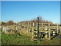
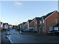
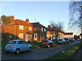
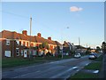
35 photos from this area
Area Information
Key information about the ME10 2SX including its size, population, and administrative classification.
- Area Type
- Postcode
- Area Size
- 32.9 hectares
- Population
- 1355
- Population Density
- 1248 people/km²
House Prices in ME10 2SX
33
Properties
£224,666
Average Sold Price
£97,500
Lowest Price
£340,000
Highest Price
Showing 33 properties
| Address | Type | Beds | Baths | Last Sale Price | Last Sale Date | |
|---|---|---|---|---|---|---|
| 31 Bramblefield Lane, East Of Iwade Pass, Sittingbourne, ME10 2SX | Semi-detached | 3 | 1 | £327,500 | Sep 2023 | |
| 30 Bramblefield Lane, East Of Iwade Pass, Sittingbourne, ME10 2SX | Semi-detached | 3 | 1 | £340,000 | Mar 2023 | |
| 42 Bramblefield Lane, East Of Iwade Pass, Sittingbourne, ME10 2SX | Bungalow | - | - | £300,000 | Oct 2019 | |
| 59 Bramblefield Lane, East Of Iwade Pass, Sittingbourne, ME10 2SX | Semi-detached | 3 | 1 | £292,000 | Feb 2019 | |
| 47 Bramblefield Lane, East Of Iwade Pass, Sittingbourne, ME10 2SX | Semi-detached | 3 | - | £250,000 | Feb 2016 | |
| 45 Bramblefield Lane, East Of Iwade Pass, Sittingbourne, ME10 2SX | Semi-detached | 2 | 1 | £170,000 | Jun 2007 | |
| 39 Bramblefield Lane, East Of Iwade Pass, Sittingbourne, ME10 2SX | Semi-detached | 2 | - | £129,995 | Sep 2003 | |
| 36 Bramblefield Lane, East Of Iwade Pass, Sittingbourne, ME10 2SX | Detached | - | - | £115,000 | Jul 2000 | |
| 57 Bramblefield Lane, East Of Iwade Pass, Sittingbourne, ME10 2SX | Semi-detached | - | - | £97,500 | Sep 1999 | |
| 34 Bramblefield Lane, East Of Iwade Pass, Sittingbourne, ME10 2SX | Bungalow | 2 | 1 | - | - |
Page 1 of 4
Energy Efficiency in ME10 2SX
Amenities
Schools
| Rank | School | Type | Entry gender | Ages |
|---|
Explore more schools in this area
Go to Schools tabDemographics
Household Size
Family (3-5 people)
most common
Accommodation Type
Houses
most common
Tenure
73
majority
Ethnic Group
White
most common
Religion
N/A
most common
Household Composition
N/A
most common
Age
47
median
Adults (30-64 years)
most common
Household Deprivation
N/A
with no deprivation
NS-SEC
30
in Lower managerial occupations
Explore more demographic insights in this area
Go to Demographics tabPlanning
Planning Constraints
- Flood RiskPremium
- Ramsar Wetland SitesPremium
- Area of Outstanding Natural BeautyPremium
- Protected Nature ReservePremium
- Protected WoodlandPremium