Area Overview for ME10 2SG
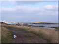
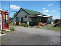
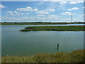
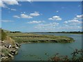
Photos of ME10 2SG


Area Information
Living in ME10 2SG means being part of a tightly packed residential cluster in England, where 1,651 people reside across 25.4 hectares. The area’s high population density of 1,359 people per square kilometre suggests a compact, community-focused environment. This postcode is not a sprawling suburb but a defined cluster of homes, likely centred around local amenities and transport links. The median age of 47 indicates a mature demographic, with most residents aged 30–64, suggesting a stable population of homeowners and long-term residents. Daily life here is likely shaped by proximity to retail, rail, and the surrounding countryside, though the area’s small size means it is not a hub for sprawling urban infrastructure. ME10 2SG’s character is defined by its balance of residential tranquillity and practical connectivity, making it suitable for those prioritising convenience over expansive space.
- Area Type
- Postcode
- Area Size
- 25.4 hectares
- Population
- 1651
- Population Density
- 1359 people/km²
The property market in ME10 2SG is dominated by owner-occupied homes, with 75% of residents living in properties they own. This contrasts with areas where rental markets are more prevalent, suggesting a community of long-term residents rather than transient tenants. The accommodation type is primarily houses, which may reflect the area’s compact layout and the preference for standalone homes over flats. Given the postcode’s small size, the housing stock is likely limited, with few new developments. Buyers should consider the area’s constraints: while the high home ownership rate indicates stability, the limited number of properties means competition for available homes. The immediate surroundings may offer similar housing types, but the small footprint of ME10 2SG means expansion is unlikely.
House Prices in ME10 2SG
Showing 1 properties
| Address | Type | Beds | Baths | Last Sale Price | Last Sale Date | |
|---|---|---|---|---|---|---|
| St Regis Paper Company Ltd, New Thames Mill, Kemsley Fields Business Park, Ridham Avenue, Kemsley, ME10 2SG | Industrial | - | - | - | - |
Energy Efficiency in ME10 2SG
ME10 2SG’s residents have access to a range of nearby amenities, including five retail outlets such as Asda Sittingbourne, Morrisons Daily Milton Regis 97, and Co-op Murston. These shops provide convenience for daily errands, from groceries to household supplies. The proximity to rail stations like Kemsley and Sittingbourne adds to the area’s practicality, enabling easy travel to larger towns for work, shopping, or leisure. While the data does not specify parks or leisure facilities, the area’s small size suggests that local green spaces or community hubs may be nearby. The combination of retail access and rail links creates a lifestyle that balances self-sufficiency with connectivity to broader networks.
Amenities
Schools
| Rank | School | Type | Entry gender | Ages |
|---|
Explore more schools in this area
Go to Schools tabDemographics
ME10 2SG’s population skews towards adults aged 30–64, with a median age of 47. This suggests a community of established professionals, families, and retirees, rather than a student or young professional demographic. Home ownership is high at 75%, indicating a stable housing market where most residents live in their own homes rather than renting. The accommodation type is predominantly houses, which aligns with the area’s higher population density and suggests a mix of family homes and single-unit properties. The predominant ethnic group is White, with no specific data on other groups provided. The age profile and ownership figures imply a low turnover of residents, fostering a sense of continuity. However, the lack of diversity data means the full picture of the community’s social fabric remains incomplete.
Household Size
Accommodation Type
Tenure
Ethnic Group
Religion
Household Composition
Age
Household Deprivation
NS-SEC
Explore more demographic insights in this area
Go to Demographics tabPlanning
Planning Constraints
- Flood RiskPremium
- Ramsar Wetland SitesPremium
- Area of Outstanding Natural BeautyPremium
- Protected Nature ReservePremium
- Protected WoodlandPremium