Area Overview for ME10 2RT
Photos of ME10 2RT


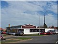
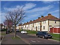
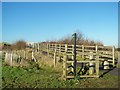
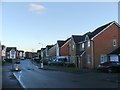
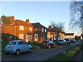
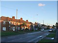
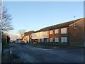
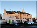

35 photos from this area
Area Information
Key information about the ME10 2RT including its size, population, and administrative classification.
- Area Type
- Postcode
- Area Size
- 1.1 hectares
- Population
- 1513
- Population Density
- 8475 people/km²
House Prices in ME10 2RT
31
Properties
£170,817
Average Sold Price
£29,900
Lowest Price
£330,000
Highest Price
Showing 31 properties
| Address | Type | Beds | Baths | Last Sale Price | Last Sale Date | |
|---|---|---|---|---|---|---|
| 43 Coldharbour Lane, Kemsley, Sittingbourne, ME10 2RT | Terraced | 2 | 1 | £251,000 | Jan 2025 | |
| 37 Coldharbour Lane, Kemsley, Sittingbourne, ME10 2RT | Terraced | 4 | 2 | £330,000 | Nov 2023 | |
| 40 Coldharbour Lane, Kemsley, Sittingbourne, ME10 2RT | house | - | - | £187,000 | Jun 2021 | |
| 35 Coldharbour Lane, Kemsley, Sittingbourne, ME10 2RT | Terraced | 3 | 1 | £104,000 | Mar 2010 | |
| 63 Coldharbour Lane, Kemsley, Sittingbourne, ME10 2RT | Terraced | 3 | 1 | £123,000 | Mar 2008 | |
| 54 Coldharbour Lane, Kemsley, Sittingbourne, ME10 2RT | Terraced | - | - | £29,900 | Dec 1996 | |
| 39 Coldharbour Lane, Kemsley, Sittingbourne, ME10 2RT | Terraced | 2 | - | - | - | |
| 62 Coldharbour Lane, Kemsley, Sittingbourne, ME10 2RT | house | - | - | - | - | |
| 44 Coldharbour Lane, Kemsley, Sittingbourne, ME10 2RT | house | - | - | - | - | |
| 41 Coldharbour Lane, Kemsley, Sittingbourne, ME10 2RT | house | - | - | - | - |
Page 1 of 4
Energy Efficiency in ME10 2RT
Amenities
Schools
| Rank | School | Type | Entry gender | Ages |
|---|
Explore more schools in this area
Go to Schools tabDemographics
Household Size
Family (3-5 people)
most common
Accommodation Type
Houses
most common
Tenure
48
majority
Ethnic Group
White
most common
Religion
N/A
most common
Household Composition
N/A
most common
Age
47
median
Adults (30-64 years)
most common
Household Deprivation
N/A
with no deprivation
NS-SEC
21
in Lower managerial occupations
Explore more demographic insights in this area
Go to Demographics tabPlanning
Planning Constraints
- Flood RiskPremium
- Ramsar Wetland SitesPremium
- Area of Outstanding Natural BeautyPremium
- Protected Nature ReservePremium
- Protected WoodlandPremium