Area Overview for ME10 2NA
Photos of ME10 2NA

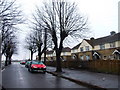
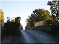
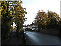
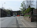
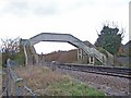

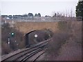
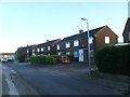
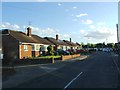
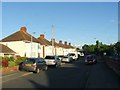
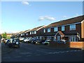
60 photos from this area
Area Information
Key information about the ME10 2NA including its size, population, and administrative classification.
- Area Type
- Postcode
- Area Size
- 1.1 hectares
- Population
- 1846
- Population Density
- 3305 people/km²
House Prices in ME10 2NA
37
Properties
£199,675
Average Sold Price
£57,000
Lowest Price
£297,500
Highest Price
Showing 37 properties
| Address | Type | Beds | Baths | Last Sale Price | Last Sale Date | |
|---|---|---|---|---|---|---|
| 19 Eastwood Road, Sittingbourne, ME10 2NA | Semi-detached | 3 | 1 | £295,000 | Jan 2025 | |
| 54 Eastwood Road, Sittingbourne, ME10 2NA | house | 3 | - | £230,000 | Mar 2021 | |
| 38 Eastwood Road, Sittingbourne, ME10 2NA | Semi-detached | 3 | 1 | £297,500 | Aug 2020 | |
| 32 Eastwood Road, Sittingbourne, ME10 2NA | Semi-detached | 3 | 1 | £238,000 | Mar 2020 | |
| 41 Eastwood Road, Sittingbourne, ME10 2NA | house | 3 | 1 | £265,000 | Oct 2019 | |
| 28 Eastwood Road, Sittingbourne, ME10 2NA | Terraced | 2 | 1 | £222,000 | Mar 2018 | |
| 31 Eastwood Road, Sittingbourne, ME10 2NA | Semi-detached | 3 | 1 | £270,000 | Oct 2017 | |
| 34 Eastwood Road, Sittingbourne, ME10 2NA | Semi-detached | 3 | 1 | £230,000 | Jun 2016 | |
| 39 Eastwood Road, Sittingbourne, ME10 2NA | house | 3 | - | £220,000 | Aug 2014 | |
| 36 Eastwood Road, Sittingbourne, ME10 2NA | house | - | - | £225,000 | Oct 2013 |
Page 1 of 4
Energy Efficiency in ME10 2NA
Amenities
Schools
| Rank | School | Type | Entry gender | Ages |
|---|
Explore more schools in this area
Go to Schools tabDemographics
Household Size
Family (3-5 people)
most common
Accommodation Type
Houses
most common
Tenure
73
majority
Ethnic Group
White
most common
Religion
N/A
most common
Household Composition
N/A
most common
Age
47
median
Adults (30-64 years)
most common
Household Deprivation
N/A
with no deprivation
NS-SEC
31
in Lower managerial occupations
Explore more demographic insights in this area
Go to Demographics tabPlanning
Planning Constraints
- Flood RiskPremium
- Ramsar Wetland SitesPremium
- Area of Outstanding Natural BeautyPremium
- Protected Nature ReservePremium
- Protected WoodlandPremium