Area Overview for ME10 1LF
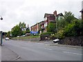
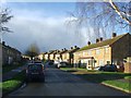
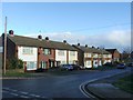
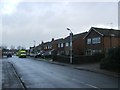
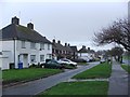
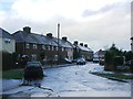
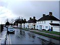
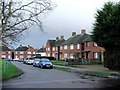
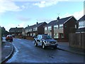
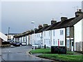
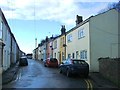
Photos of ME10 1LF

Area Information
Living in ME10 1LF offers a quiet, family-oriented lifestyle in a small residential cluster with a population of 1502. The area is characterised by its stability, with a median age of 47 and a community predominantly composed of adults aged 30–64. Most residents own their homes, with 92% of properties in private ownership, reflecting a long-established local population. The area’s compact size means daily life is centred around nearby amenities, including schools, shops, and rail links. With no major environmental constraints or flood risks, it provides a secure base for families and professionals. The proximity to primary schools, combined with good broadband and rail connectivity, makes it appealing for those seeking a balanced mix of convenience and tranquillity. While small, the area is well-served by essential services, ensuring residents can access what they need without venturing far.
- Area Type
- Postcode
- Area Size
- Not available
- Population
- 1502
- Population Density
- 3464 people/km²
The property market in ME10 1LF is dominated by owner-occupied homes, with 92% of properties in private hands. This high rate of home ownership suggests a mature market where long-term residency is the norm rather than short-term investment. The area is characterised by houses rather than flats, which may appeal to families seeking more space and privacy. Given the small size of the postcode and its residential focus, the housing stock is likely limited but of good quality. Buyers should consider that the market is not driven by rental demand, meaning properties may be held by residents with no immediate need to sell. For those seeking a stable, low-maintenance area, ME10 1LF offers a compact, well-established housing environment with minimal turnover.
House Prices in ME10 1LF
No properties found in this postcode.
Energy Efficiency in ME10 1LF
Daily life in ME10 1LF is supported by a range of nearby amenities, including five retail outlets such as Budgens MRH, Tesco Milton, and Co-op Sittingbourne. These shops provide access to groceries, household essentials, and other services, reducing the need for long trips. The area’s rail network, with stations at Sittingbourne, Kemsley, and Newington, connects residents to broader transport routes, facilitating travel to work, leisure, or social events. While the data does not mention parks or leisure facilities, the presence of multiple retail and transport options suggests a practical, community-focused lifestyle. Residents can enjoy a balance of convenience and accessibility, with essential services within easy reach. The compact nature of the area ensures that amenities are not distant, supporting a low-stress, efficient daily routine.
Amenities
Schools
Residents of ME10 1LF have access to three primary schools: Barrow Grove Junior School, Woodgrove Primary School, and Westlands Primary School, which holds an Ofsted rating of ‘good’. These institutions cater to younger children, providing a range of educational options within the local area. The presence of multiple primary schools suggests a family-friendly environment, where parents can choose between different schools based on proximity or specific needs. While no secondary schools are listed in the data, the availability of primary education is a strong asset for families with young children. The ‘good’ rating at Westlands Primary School indicates a reliable standard of teaching and facilities, though further details on curriculum or performance metrics are not provided.
| Rank | School | Type | Entry gender | Ages |
|---|
Explore more schools in this area
Go to Schools tabDemographics
The community in ME10 1LF is predominantly composed of adults aged 30–64, with a median age of 47. This suggests a mature, settled population, likely with established careers and families. Home ownership is exceptionally high at 92%, indicating a strong preference for long-term residency over rental properties. The area is primarily made up of houses, not flats, which aligns with the demographic profile of older, family-oriented households. The predominant ethnic group is White, with no specific data on diversity or deprivation levels provided. This composition points to a stable, low-turnover community where residents are likely to remain in their homes for extended periods. The absence of significant deprivation data implies a generally consistent quality of life, though further details on socioeconomic variation are not available.
Household Size
Accommodation Type
Tenure
Ethnic Group
Religion
Household Composition
Age
Household Deprivation
NS-SEC
Explore more demographic insights in this area
Go to Demographics tabPlanning
Planning Constraints
- Flood RiskPremium
- Ramsar Wetland SitesPremium
- Area of Outstanding Natural BeautyPremium
- Protected Nature ReservePremium
- Protected WoodlandPremium