Area Overview for ME10 1JS
Photos of ME10 1JS
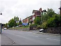
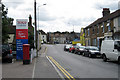
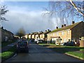
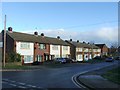
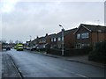
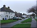
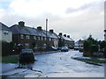
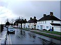
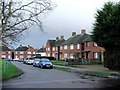
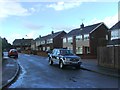
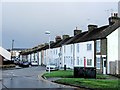
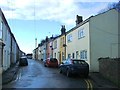
45 photos from this area
Area Information
Key information about the ME10 1JS including its size, population, and administrative classification.
- Area Type
- Postcode
- Area Size
- 1.1 hectares
- Population
- 1411
- Population Density
- 7664 people/km²
House Prices in ME10 1JS
16
Properties
£210,000
Average Sold Price
£94,000
Lowest Price
£355,000
Highest Price
Showing 16 properties
| Address | Type | Beds | Baths | Last Sale Price | Last Sale Date | |
|---|---|---|---|---|---|---|
| 7 Johnson Road, Sittingbourne, ME10 1JS | Terraced | 3 | 1 | £310,000 | Sep 2025 | |
| 3 Johnson Road, Sittingbourne, ME10 1JS | house | 3 | 1 | £220,000 | Jul 2019 | |
| 2 Johnson Road, Sittingbourne, ME10 1JS | house | 4 | 2 | £355,000 | Feb 2018 | |
| 5 Johnson Road, Sittingbourne, ME10 1JS | Terraced | 3 | 1 | £250,000 | Sep 2017 | |
| 9 Johnson Road, Sittingbourne, ME10 1JS | Semi-detached | 3 | 2 | £227,500 | Dec 2015 | |
| 17 Johnson Road, Sittingbourne, ME10 1JS | Semi-detached | 3 | - | £216,000 | Jul 2014 | |
| 15 Johnson Road, Sittingbourne, ME10 1JS | Semi-detached | 3 | 2 | £175,000 | May 2014 | |
| The Stables, Johnson Road, Sittingbourne, ME10 1JS | Detached | - | - | £94,000 | Oct 2013 | |
| 1 Johnson Road, Sittingbourne, ME10 1JS | Terraced | 3 | 1 | £155,000 | Jun 2004 | |
| 19 Johnson Road, Sittingbourne, ME10 1JS | Semi-detached | - | - | £97,500 | Dec 1999 |
Page 1 of 2
Energy Efficiency in ME10 1JS
Amenities
Schools
| Rank | School | Type | Entry gender | Ages |
|---|
Explore more schools in this area
Go to Schools tabDemographics
Household Size
One person
most common
Accommodation Type
Houses
most common
Tenure
50
majority
Ethnic Group
White
most common
Religion
N/A
most common
Household Composition
N/A
most common
Age
47
median
Adults (30-64 years)
most common
Household Deprivation
N/A
with no deprivation
NS-SEC
26
in Lower managerial occupations
Explore more demographic insights in this area
Go to Demographics tabPlanning
Planning Constraints
- Flood RiskPremium
- Ramsar Wetland SitesPremium
- Area of Outstanding Natural BeautyPremium
- Protected Nature ReservePremium
- Protected WoodlandPremium