Area Overview for ME10 1GB
Photos of ME10 1GB
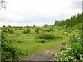
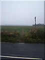
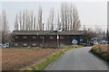
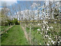

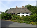
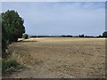
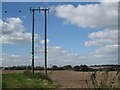
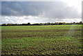
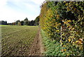
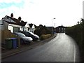
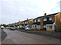
25 photos from this area
Area Information
Key information about the ME10 1GB including its size, population, and administrative classification.
- Area Type
- Postcode
- Area Size
- 4.6 hectares
- Population
- 2599
- Population Density
- 362 people/km²
House Prices in ME10 1GB
34
Properties
£277,971
Average Sold Price
£90,950
Lowest Price
£505,000
Highest Price
Showing 34 properties
| Address | Type | Beds | Baths | Last Sale Price | Last Sale Date | |
|---|---|---|---|---|---|---|
| 18 Maylam Gardens, Borden, ME10 1GB | Terraced | 3 | 1 | £300,000 | Jul 2023 | |
| 64 Maylam Gardens, Borden, ME10 1GB | Detached | 4 | 2 | £451,250 | Apr 2023 | |
| 6 Maylam Gardens, Borden, ME10 1GB | Detached | 4 | 1 | £505,000 | Mar 2023 | |
| 60 Maylam Gardens, Borden, ME10 1GB | Terraced | 3 | 2 | £480,000 | Dec 2022 | |
| 62 Maylam Gardens, Borden, ME10 1GB | house | - | - | £475,000 | Sep 2021 | |
| 28 Maylam Gardens, Borden, ME10 1GB | Terraced | 2 | - | £248,000 | Nov 2020 | |
| 8 Maylam Gardens, Borden, ME10 1GB | Detached | 4 | 2 | £375,000 | Jan 2020 | |
| 20 Maylam Gardens, Borden, ME10 1GB | Detached | 4 | 2 | £445,000 | Dec 2019 | |
| 10 Maylam Gardens, Borden, ME10 1GB | Semi-detached | 3 | 2 | £242,500 | Jul 2019 | |
| 12 Maylam Gardens, Borden, ME10 1GB | Semi-detached | 3 | 2 | £283,000 | Jul 2018 |
Page 1 of 4
Energy Efficiency in ME10 1GB
Amenities
Schools
| Rank | School | Type | Entry gender | Ages |
|---|
Explore more schools in this area
Go to Schools tabDemographics
Household Size
Two person
most common
Accommodation Type
Houses
most common
Tenure
80
majority
Ethnic Group
White
most common
Religion
N/A
most common
Household Composition
N/A
most common
Age
47
median
Adults (30-64 years)
most common
Household Deprivation
N/A
with no deprivation
NS-SEC
35
in Lower managerial occupations
Explore more demographic insights in this area
Go to Demographics tabPlanning
Planning Constraints
- Flood RiskPremium
- Ramsar Wetland SitesPremium
- Area of Outstanding Natural BeautyPremium
- Protected Nature ReservePremium
- Protected WoodlandPremium