Area Overview for ME10 1EL
Photos of ME10 1EL


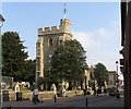
100 photos from this area
Area Information
Key information about the ME10 1EL including its size, population, and administrative classification.
- Area Type
- Postcode
- Area Size
- 5.1 hectares
- Population
- 1356
- Population Density
- 2703 people/km²
House Prices in ME10 1EL
49
Properties
£281,740
Average Sold Price
£68,500
Lowest Price
£907,500
Highest Price
Showing 49 properties
| Address | Type | Beds | Baths | Last Sale Price | Last Sale Date | |
|---|---|---|---|---|---|---|
| 56A Albany Road, Sittingbourne, ME10 1EL | Terraced | 4 | 1 | £365,000 | Feb 2024 | |
| 78 Albany Road, Sittingbourne, ME10 1EL | Semi-detached | 3 | 2 | £400,000 | Jan 2023 | |
| Craigmore, 96 Albany Road, Sittingbourne, ME10 1EL | Detached | 5 | 2 | £907,500 | Dec 2022 | |
| 56 Albany Road, Sittingbourne, ME10 1EL | Terraced | 3 | 1 | £275,000 | Feb 2019 | |
| 68 Albany Road, Sittingbourne, ME10 1EL | Semi-detached | 4 | 2 | £360,000 | Sep 2018 | |
| 62 Albany Road, Sittingbourne, ME10 1EL | house | - | - | £350,000 | Dec 2015 | |
| 90 Albany Road, Sittingbourne, ME10 1EL | Detached | 4 | 3 | £458,000 | Dec 2015 | |
| 98 Albany Road, Sittingbourne, ME10 1EL | Detached | 4 | - | £385,000 | Mar 2014 | |
| 84 Albany Road, Sittingbourne, ME10 1EL | Semi-detached | 3 | - | £230,000 | Feb 2014 | |
| 92 Albany Road, Sittingbourne, ME10 1EL | Detached | 4 | 2 | £410,000 | Sep 2010 |
Page 1 of 5
Energy Efficiency in ME10 1EL
Amenities
Schools
| Rank | School | Type | Entry gender | Ages |
|---|
Explore more schools in this area
Go to Schools tabDemographics
Household Size
Family (3-5 people)
most common
Accommodation Type
Houses
most common
Tenure
77
majority
Ethnic Group
White
most common
Religion
N/A
most common
Household Composition
N/A
most common
Age
47
median
Adults (30-64 years)
most common
Household Deprivation
N/A
with no deprivation
NS-SEC
36
in Lower managerial occupations
Explore more demographic insights in this area
Go to Demographics tabPlanning
Planning Constraints
- Flood RiskPremium
- Ramsar Wetland SitesPremium
- Area of Outstanding Natural BeautyPremium
- Protected Nature ReservePremium
- Protected WoodlandPremium