Area Overview for ME10 1AR
Photos of ME10 1AR


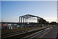
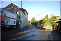
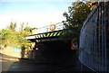
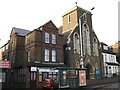

100 photos from this area
Area Information
Key information about the ME10 1AR including its size, population, and administrative classification.
- Area Type
- Postcode
- Area Size
- 7618 m²
- Population
- 1411
- Population Density
- 7664 people/km²
House Prices in ME10 1AR
11
Properties
-
Average Sold Price
-
Lowest Price
-
Highest Price
Showing 11 properties
| Address | Type | Beds | Baths | Last Sale Price | Last Sale Date | |
|---|---|---|---|---|---|---|
| 74A West Street, Sittingbourne, ME10 1AR | Retail | - | - | - | - | |
| Flat, 60 West Street, Sittingbourne, ME10 1AR | Semi-detached | 4 | - | - | - | |
| Beauty Sanctuary Ltd, First Floor, 62-64 West Street, Sittingbourne, ME10 1AR | warehouse | - | - | - | - | |
| Canvas, Centre House, 62-64 West Street, Sittingbourne, ME10 1AR | shop | - | - | - | - | |
| Inpost, Inpost Locker, Lidl Sittingbourne, 52 West Street, Sittingbourne, ME10 1AR | Retail | - | - | - | - | |
| Chatter Tots, 70-72 West Street, Sittingbourne, ME10 1AR | commercial | - | - | - | - | |
| 66 West Street, Sittingbourne, ME10 1AR | shop | - | - | - | - | |
| Flat Above, 58 West Street, Sittingbourne, ME10 1AR | Flat | - | - | - | - | |
| Flat, 54-56 West Street, Sittingbourne, ME10 1AR | Flat | - | - | - | - | |
| Flat Above, 70-72 West Street, Sittingbourne, ME10 1AR | Flat | - | - | - | - |
Page 1 of 2
Energy Efficiency in ME10 1AR
Amenities
Schools
| Rank | School | Type | Entry gender | Ages |
|---|
Explore more schools in this area
Go to Schools tabDemographics
Household Size
One person
most common
Accommodation Type
Houses
most common
Tenure
50
majority
Ethnic Group
White
most common
Religion
N/A
most common
Household Composition
N/A
most common
Age
47
median
Adults (30-64 years)
most common
Household Deprivation
N/A
with no deprivation
NS-SEC
26
in Lower managerial occupations
Explore more demographic insights in this area
Go to Demographics tabPlanning
Planning Constraints
- Flood RiskPremium
- Ramsar Wetland SitesPremium
- Area of Outstanding Natural BeautyPremium
- Protected Nature ReservePremium
- Protected WoodlandPremium