Area Overview for ME1 2EG
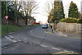
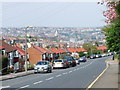
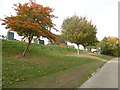
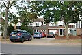
Photos of ME1 2EG


Area Information
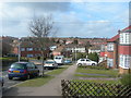
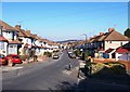
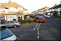
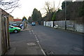
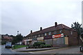
Living in ME1 2EG offers a compact, residential experience shaped by its small population of 1494 and its role as a focused postcode cluster. This area is defined by its proximity to key transport links, including multiple railway stations and a nearby airport, making it accessible for commuters and frequent travellers. The community here is predominantly composed of adults aged 30–64, reflecting a stable, middle-aged demographic. Daily life is characterised by a balance of local amenities and practical connectivity, with shops like Asda Rochester and Co-op Dickens within easy reach. The area’s low flood risk and below-average crime rate contribute to a sense of security, while the absence of environmental constraints such as protected woodlands or Areas of Outstanding Natural Beauty means development is not restricted by ecological designations. ME1 2EG is ideal for those seeking a quiet, family-oriented environment with reliable infrastructure, though its small size means it is best suited to those prioritising convenience over expansive space.
- Area Type
- Postcode
- Area Size
- Not available
- Population
- 1494
- Population Density
- 6625 people/km²
The property market in ME1 2EG is dominated by owner-occupied homes, with 79% of residents owning their properties. This high ownership rate indicates a community of established residents rather than a rental-heavy market, which can be appealing to buyers seeking long-term stability. The accommodation type is primarily houses, which suggests a focus on single-family homes rather than apartments or flats. Given the area’s small size, the housing stock is likely limited in volume, making it a niche market for those prioritising proximity to transport links and local amenities. Buyers should consider that the area’s compact nature means property availability may be constrained, though the absence of planning constraints or environmental restrictions could simplify the purchase process. This makes ME1 2EG suitable for those seeking a secure, low-maintenance home in a low-risk environment.
House Prices in ME1 2EG
No properties found in this postcode.
Energy Efficiency in ME1 2EG
Residents of ME1 2EG have access to a range of practical amenities within walking or short driving distance. Retail options include Asda Rochester, Co-op Dickens, and Spar, providing everyday shopping convenience. The area’s rail network is particularly strong, with five stations—including Chatham, Rochester, and Strood—offering regular services to nearby towns and cities. Rochester Airport is also nearby, adding to the area’s appeal for frequent travellers. While the data does not mention parks or leisure facilities, the absence of environmental restrictions suggests that local green spaces may be available. The compact nature of the area means that daily errands and commuting are efficiently managed, though those seeking extensive recreational options may need to look beyond the immediate vicinity. The combination of retail, transport, and travel links creates a lifestyle focused on practicality and accessibility.
Amenities
Schools
| Rank | School | Type | Entry gender | Ages |
|---|
Explore more schools in this area
Go to Schools tabDemographics
The community in ME1 2EG is largely composed of adults aged 30–64, with a median age of 47, indicating a mature, settled population. Home ownership is high, at 79%, suggesting a strong presence of long-term residents rather than transient renters. The accommodation type is predominantly houses, which aligns with the area’s small, residential character. The predominant ethnic group is White, reflecting a homogenous demographic profile. This age group and ownership pattern suggest a community focused on stability and long-term living, with fewer young families or elderly residents compared to other areas. The absence of specific data on deprivation means that quality of life is inferred from the low crime rate and reliable infrastructure, though further local insights would be needed to fully assess socioeconomic diversity.
Household Size
Accommodation Type
Tenure
Ethnic Group
Religion
Household Composition
Age
Household Deprivation
NS-SEC
Explore more demographic insights in this area
Go to Demographics tabPlanning
Planning Constraints
- Flood RiskPremium
- Ramsar Wetland SitesPremium
- Area of Outstanding Natural BeautyPremium
- Protected Nature ReservePremium
- Protected WoodlandPremium