Area Overview for Matfield
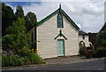
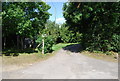
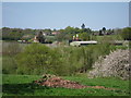
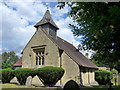
Photos of Matfield

Area Information
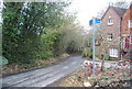
Living in Matfield offers a defined sense of place within a built-up area covering 49.8 hectares. You will find this neighbourhood characterised by its established residential fabric, situated in Kent, England. The community feels settled, with a strong sense of routine shaped by the immediate surroundings. Daily life here revolves around practical access to local services and the reliability of neighbours rather than rapid urban expansion. The area functions as a cohesive residential zone where residents benefit from proximity to key transport links and local shops. A homebuyer looking at Matfield finds a district that balances quiet suburban living with reasonable connectivity to wider networks. The size of the area means you are not isolated from major towns while retaining a distinct local identity. You do not need to travel far to reach rail stations or supermarkets, which supports an independent lifestyle. The environment supports those who value stability and known routes over the unpredictability of fast-changing city developments. The physical layout accommodates a range of housing needs, though the area density suggests a tightly knit community structure. Residents here typically plan their lives around footable distances to amenities and established transport corridors. The area does not feature the chaos of high-density city centres, nor does it suffer the isolation of rural farmland. Instead, it occupies a middle ground common to many established built-up zones. You can look forward to a predictable environment where infrastructure supports consistent daily living. The neighbourhood provides a stable backdrop for family life or for those seeking a quieter retirement setting without sacrificing access to essential services.
- Area Type
- Built Up Area 250
- Area Size
- 49.8 hectares
- Population
- Not available
- Population Density
- Not available
Your daily lifestyle in Matfield benefits from a collection of specific retail and transport amenities within easy reach. You will find five retail outlets spread across the immediate neighbourhood. Notable names include M&S Blue Boys Tonbridge, Tesco Paddock, and Waitrose Paddock. The presence of these major supermarket brands suggests you can source most groceries and general necessities without travelling far. You do not need to drive into larger towns to find basic provisions. Transport options further enhance your convenience with five nearby rail stations including Paddock Wood, Beltring, and High Brooms. Plus, Tunbridge Wells West offers metro access. These eight total transport and retail touchpoints create a practical radius for errands. If you prefer walking, the high density of these amenities supports a car-lite existence for non-essential trips. The variety of shops means you can choose between the convenience of M&S or the quality focus of Waitrose depending on your preference. Parks and leisure facilities are implied by the built-up nature but specific park names are not listed in the immediate amenity data. However, the retail and transport data confirms a well-serviced environment. Residents enjoy the convenience of having major high-street names close by. This setup supports an active lifestyle where quick trips to the shops or coffee runs are straightforward. You can plan your weekly schedule around the opening times of Tesco Paddock or Waitrose Paddock with confidence that they are the dominant retail players in the vicinity.
Amenities
Schools
| Rank | School | Type | Entry gender | Ages |
|---|
Explore more schools in this area
Go to Schools tabDemographics
The community in Matfield presents a distinct age profile with a median age of 70. This figure indicates that the majority of the population consists of older residents, which shapes the character of the local high streets and community groups. You will find a neighbourhood where life pace generally reflects the needs of a mature demographic. The household composition data is recorded under total categories without specific breakdowns, suggesting a standard pattern for the region but lacking granular detail on family structures within this specific hectare count. Home ownership stands at 80 percent within Matfield. This high rate suggests that most residents have a long-standing connection to their properties and likely own freehold homes. Such levels of ownership typically correlate with stability, lower rental turnover, and a community invested in local maintenance. The predominant ethnic group, religion, and accommodation type details are listed as total, indicating these fall within standard national or regional averages rather than showing unique trends specific to this postcode sector. Because the median age is 70, you might expect services to cater to older age groups, though specific deprivation data is not included in the current profile. The high ownership rate contrasts with areas where rental markets dominate, meaning you will encounter fewer transient tenants. The population density across the 49.8 hectares supports a quiet but active community life. Residents here likely value security and established routines alongside the proximity to nearby rail lines that connect them to larger employment centres.