Area Overview for LU7 9DP
Photos of LU7 9DP
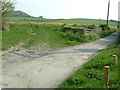
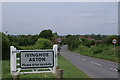
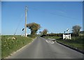
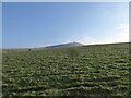
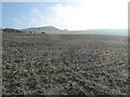
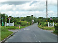
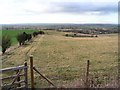
12 photos from this area
Area Information
Key information about the LU7 9DP including its size, population, and administrative classification.
- Area Type
- Postcode
- Area Size
- 1.3 km²
- Population
- 2812
- Population Density
- 178 people/km²
House Prices in LU7 9DP
28
Properties
£508,931
Average Sold Price
£118,000
Lowest Price
£1,500,000
Highest Price
Showing 28 properties
| Address | Type | Beds | Baths | Last Sale Price | Last Sale Date | |
|---|---|---|---|---|---|---|
| Riffhams, Ivinghoe Aston, Ivinghoe, LU7 9DP | Detached | 5 | 2 | £665,000 | Sep 2023 | |
| 10, Council Houses, Ivinghoe Aston, Ivinghoe, LU7 9DP | house | 3 | 1 | £435,000 | Oct 2022 | |
| Glendower, Ivinghoe Aston, Ivinghoe, LU7 9DP | Semi-detached | 3 | 1 | £525,000 | Jan 2021 | |
| Beacon Cottage, Ivinghoe Aston, Ivinghoe, LU7 9DP | house | - | - | £337,500 | Jul 2010 | |
| The Old School, Ivinghoe Aston, Ivinghoe, LU7 9DP | house | 3 | - | £291,000 | May 2007 | |
| 8, Council Houses, Ivinghoe Aston, Ivinghoe, LU7 9DP | Semi-detached | - | - | £199,950 | Sep 2005 | |
| Crabtree Cottage, Ivinghoe Aston, Ivinghoe, LU7 9DP | Detached | - | - | £1,500,000 | Sep 2003 | |
| Old Post Office, Ivinghoe Aston, Ivinghoe, LU7 9DP | Detached | - | - | £118,000 | Mar 1997 | |
| Ridge View, Ivinghoe Aston, Ivinghoe, LU7 9DP | Detached | 4 | 2 | - | - | |
| Old School House, Ivinghoe Aston, Ivinghoe, LU7 9DP | Semi-detached | 3 | 1 | - | - |
Page 1 of 3
Energy Efficiency in LU7 9DP
Amenities
Schools
| Rank | School | Type | Entry gender | Ages |
|---|
Explore more schools in this area
Go to Schools tabDemographics
Household Size
Family (3-5 people)
most common
Accommodation Type
Houses
most common
Tenure
81
majority
Ethnic Group
White
most common
Religion
N/A
most common
Household Composition
N/A
most common
Age
47
median
Adults (30-64 years)
most common
Household Deprivation
N/A
with no deprivation
NS-SEC
48
in Lower managerial occupations
Explore more demographic insights in this area
Go to Demographics tabPlanning
Planning Constraints
- Flood RiskPremium
- Ramsar Wetland SitesPremium
- Area of Outstanding Natural BeautyPremium
- Protected Nature ReservePremium
- Protected WoodlandPremium