Area Overview for LU7 0UJ
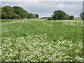
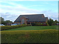
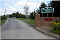
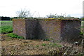
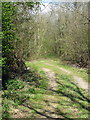
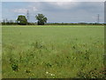
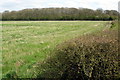
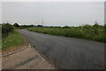
Photos of LU7 0UJ


Area Information
Living in LU7 0UJ offers a quiet, residential experience in a small cluster of homes spread across 63.9 hectares. With a population of 1,645 and a density of 101 people per square kilometre, the area feels spacious yet connected. This postcode is ideal for those seeking a low-density, family-oriented environment, where the majority of residents are adults aged 30–64. The community is predominantly home-owning, with 85% of properties occupied by owners, suggesting a stable, long-term demographic. Proximity to retail outlets like Tesco Linslade and rail stations such as Leighton Buzzard Railway Station ensures practical access to essentials. While LU7 0UJ is not a bustling urban hub, its charm lies in its simplicity—small, well-maintained homes, low crime rates, and a peaceful setting. For buyers prioritising safety, convenience, and a sense of community, this area provides a straightforward, uncluttered lifestyle.
- Area Type
- Postcode
- Area Size
- 63.9 hectares
- Population
- 1645
- Population Density
- 101 people/km²
The property market in LU7 0UJ is characterised by a high rate of home ownership—85% of properties are owner-occupied—indicating a community of long-term residents rather than a rental market. The accommodation type is predominantly houses, which suggests a focus on family homes and single-unit properties. Given the small area size and limited population, the housing stock is unlikely to be extensive, making this a niche market for buyers seeking a specific, low-density environment. The prevalence of houses rather than flats or apartments means properties are likely larger and more suited to households requiring private space. Buyers should consider the proximity to amenities like schools and rail links, which enhance the area’s appeal despite its modest scale. The market’s stability, driven by high ownership rates, may offer predictable value retention for those prioritising security over rapid growth.
House Prices in LU7 0UJ
No properties found in this postcode.
Energy Efficiency in LU7 0UJ
The lifestyle in LU7 0UJ is shaped by its proximity to retail and transport hubs. Within practical reach are five retail outlets, including Tesco Linslade and Spar, offering everyday shopping needs. The area’s rail connections—Leighton Buzzard, Cheddington, and Bletchley stations—provide access to broader regional networks, enhancing mobility for work, leisure, or travel. While the data does not specify parks or leisure facilities, the low population density and absence of planning constraints suggest ample open space. The character of daily life here is defined by convenience: essential services are nearby, and transport links facilitate easy movement. For buyers seeking a balance between privacy and accessibility, LU7 0UJ offers a straightforward, practical lifestyle with minimal need for long commutes or extensive travel.
Amenities
Schools
The nearest school to LU7 0UJ is Overstone Combined School, a primary school with an Ofsted rating of satisfactory. This provides families with access to a local educational institution, though the absence of secondary schools in the immediate area means parents may need to look further afield for secondary education. The presence of a primary school suggests the area is well-served for younger children, supporting families with children in the early stages of schooling. However, the lack of detailed data on secondary schools or other educational facilities means prospective buyers should investigate nearby options. For those prioritising a school within walking distance, Overstone Combined School offers a practical solution, though its rating indicates there may be room for improvement in educational standards.
| Rank | School | Type | Entry gender | Ages |
|---|
Explore more schools in this area
Go to Schools tabDemographics
The community in LU7 0UJ is defined by its mature demographic, with a median age of 47 and the majority of residents aged 30–64. This suggests a population of established professionals and families, with 85% of homes owned by occupants rather than rented. The accommodation is almost entirely houses, indicating a preference for single-family living. The predominant ethnic group is White, reflecting a homogenous demographic profile. With a population density of 101 people per square kilometre, the area avoids overcrowding, offering a balance between seclusion and accessibility. The low population density and high home ownership rate imply a stable, long-term community with minimal turnover. For those considering LU7 0UJ, the data suggests a lifestyle centred on stability, with limited pressure from transient populations or rental-driven market fluctuations.
Household Size
Accommodation Type
Tenure
Ethnic Group
Religion
Household Composition
Age
Household Deprivation
NS-SEC
Explore more demographic insights in this area
Go to Demographics tabPlanning
Planning Constraints
- Flood RiskPremium
- Ramsar Wetland SitesPremium
- Area of Outstanding Natural BeautyPremium
- Protected Nature ReservePremium
- Protected WoodlandPremium