Area Overview for LU7 0HA
Photos of LU7 0HA
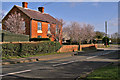
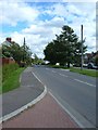
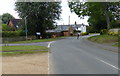
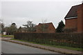
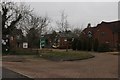
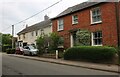
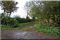
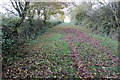
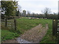
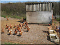
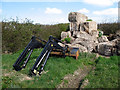
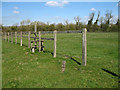
14 photos from this area
Area Information
Key information about the LU7 0HA including its size, population, and administrative classification.
- Area Type
- Postcode
- Area Size
- 3.7 hectares
- Population
- 1870
- Population Density
- 116 people/km²
House Prices in LU7 0HA
14
Properties
£363,688
Average Sold Price
£191,000
Lowest Price
£520,000
Highest Price
Showing 14 properties
| Address | Type | Beds | Baths | Last Sale Price | Last Sale Date | |
|---|---|---|---|---|---|---|
| 4 Chapel Square, Stewkley, LU7 0HA | Detached | 2 | 1 | £445,000 | Jul 2025 | |
| 9 Chapel Square, Stewkley, LU7 0HA | Terraced | 1 | 1 | £250,000 | Sep 2024 | |
| Chapel House, 3 Chapel Square, Stewkley, LU7 0HA | Detached | 4 | 2 | £520,000 | Nov 2020 | |
| 10 Chapel Square, Stewkley, LU7 0HA | Cottage | 2 | - | £191,000 | Oct 2015 | |
| The Old School, Chapel Square, Stewkley, LU7 0HA | Detached | 5 | 2 | £484,500 | Aug 2009 | |
| Jacobs Cottage, 7A Chapel Square, Stewkley, LU7 0HA | Detached | - | - | £462,000 | Feb 2007 | |
| 8 Chapel Square, Stewkley, LU7 0HA | Terraced | - | - | £217,000 | Aug 2002 | |
| The Pumphouse, 7C Chapel Square, Stewkley, LU7 0HA | Detached | - | - | £340,000 | Oct 1997 | |
| Lower Penfold, 7B Chapel Square, Stewkley, LU7 0HA | Detached | - | - | - | - | |
| Fern Cottage, 6 Chapel Square, Stewkley, LU7 0HA | house | - | - | - | - |
Page 1 of 2
Energy Efficiency in LU7 0HA
Amenities
Schools
| Rank | School | Type | Entry gender | Ages |
|---|
Explore more schools in this area
Go to Schools tabDemographics
Household Size
Two person
most common
Accommodation Type
Houses
most common
Tenure
79
majority
Ethnic Group
White
most common
Religion
N/A
most common
Household Composition
N/A
most common
Age
47
median
Adults (30-64 years)
most common
Household Deprivation
N/A
with no deprivation
NS-SEC
45
in Lower managerial occupations
Explore more demographic insights in this area
Go to Demographics tabPlanning
Planning Constraints
- Flood RiskPremium
- Ramsar Wetland SitesPremium
- Area of Outstanding Natural BeautyPremium
- Protected Nature ReservePremium
- Protected WoodlandPremium