Area Overview for LU7 0FG
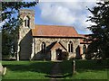
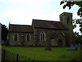
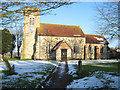
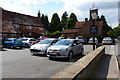
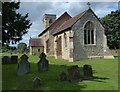
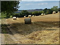
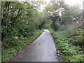
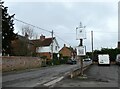
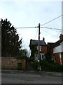
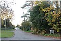
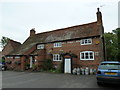
Photos of LU7 0FG
Area Information
Living in LU7 0FG offers a quiet, low-density residential experience in a small cluster of homes. With a population of 1,312 spread over an area that supports 61 people per square kilometre, this postcode area feels intentionally uncluttered. The community is defined by its modest scale, where daily life unfolds with a sense of familiarity. Residents benefit from proximity to multiple railway stations, including Leighton Buzzard and Aylesbury Vale Parkway, which connect to broader regional networks. While the area lacks major urban amenities, its compact nature ensures that essentials are within practical reach. The demographic profile suggests a stable, mature population, with adults aged 30–64 forming the majority. This balance between seclusion and accessibility makes LU7 0FG appealing to those seeking a slower pace of life without sacrificing connectivity. The absence of environmental constraints, such as protected woodlands or flood zones, further adds to its practicality for homeowners. For buyers, the area presents a straightforward choice: a small, well-defined cluster of homes with minimal planning complexities.
- Area Type
- Postcode
- Area Size
- Not available
- Population
- 1312
- Population Density
- 61 people/km²
The property market in LU7 0FG is characterised by a high rate of home ownership (71%) and a focus on houses rather than flats or apartments. This suggests a market skewed towards owner-occupied properties, with fewer rental opportunities compared to areas with higher population density. The small cluster of homes means the housing stock is limited, which could make the area appealing to buyers seeking a quieter, less competitive environment. The predominance of houses indicates a preference for private, standalone living spaces, which may align with the area’s low population density. For buyers, this means a niche market where properties are likely to be in stable demand, though the limited number of homes could mean fewer options. The absence of planning constraints or environmental restrictions also simplifies the purchasing process, reducing potential complications for new homeowners.
House Prices in LU7 0FG
No properties found in this postcode.
Energy Efficiency in LU7 0FG
Residents of LU7 0FG have access to a range of nearby amenities, including five retail outlets such as Budgens Watermead, Tesco Linslade, and Tesco Kingsbrook. These stores provide essential shopping options for groceries and daily needs. The area’s railway stations—Leighton Buzzard, Aylesbury Vale Parkway, and Aylesbury—offer easy access to broader regional services, including public transport links to larger urban centres. While the area itself is small, the proximity to these stations means residents can reach more extensive leisure, dining, and retail options in nearby towns. The presence of multiple retail points within practical reach supports a convenient lifestyle, reducing the need for long journeys. The combination of local shops and rail connectivity creates a balance between self-sufficiency and external opportunities, catering to both daily necessities and occasional outings.
Amenities
Schools
| Rank | School | Type | Entry gender | Ages |
|---|
Explore more schools in this area
Go to Schools tabDemographics
The community in LU7 0FG is predominantly composed of adults aged 30–64, with a median age of 47. This suggests a population that is largely established, with fewer young families or retirees compared to other areas. Home ownership is high, at 71%, indicating a stable residential base where most residents live in their own homes rather than renting. The accommodation type is primarily houses, which aligns with the low population density and the area’s small-scale layout. The predominant ethnic group is White, reflecting a homogenous demographic profile. While no specific data on deprivation is provided, the high home ownership rate and absence of environmental constraints suggest a community with relatively stable economic conditions. The age profile implies a population that may prioritise long-term residency over frequent relocation, contributing to a consistent local character.
Household Size
Accommodation Type
Tenure
Ethnic Group
Religion
Household Composition
Age
Household Deprivation
NS-SEC
Explore more demographic insights in this area
Go to Demographics tabPlanning
Planning Constraints
- Flood RiskPremium
- Ramsar Wetland SitesPremium
- Area of Outstanding Natural BeautyPremium
- Protected Nature ReservePremium
- Protected WoodlandPremium