Area Overview for LU7 0FA
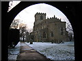
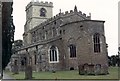
Photos of LU7 0FA


Area Information
LU7 0FA is a small, tightly knit residential cluster in England, home to 1,334 people spread across a compact area with a density of 403 people per square kilometre. This postcode area reflects a quiet, established community, where daily life is shaped by proximity to local amenities and a low crime rate. The area’s character is defined by its modest scale, with homes predominantly built for long-term occupancy. Residents benefit from easy access to nearby retail hubs and rail links, making it practical for commuters while retaining a village-like atmosphere. The median age of 47 suggests a mature population, with many households likely to be families or long-standing residents. Living here means a balance between convenience and tranquillity, with no significant environmental constraints or flood risks to disrupt daily life. The area’s small size means it is ideal for those seeking a manageable, low-maintenance lifestyle without sacrificing access to essential services.
- Area Type
- Postcode
- Area Size
- Not available
- Population
- 1334
- Population Density
- 403 people/km²
The property market in LU7 0FA is characterised by a high rate of home ownership (60%), with houses forming the majority of the housing stock. This suggests a community where long-term residency is common, and properties are likely to be family homes rather than short-term rentals. The small size of the area means the housing stock is limited, so buyers may need to consider nearby postcode areas for more options. The prevalence of houses, rather than flats, indicates a focus on private, spacious living, which may appeal to those prioritising space and privacy. However, the compact nature of LU7 0FA means the property market is not vast, and competition for available homes could be keen. Buyers should also consider the broader regional context, as the immediate surroundings may offer additional choices for those seeking specific property types or sizes.
House Prices in LU7 0FA
No properties found in this postcode.
Energy Efficiency in LU7 0FA
LU7 0FA offers a range of amenities within practical reach, including five retail outlets such as Tesco Linslade, Aldi Grovebury, and M&S Leighton. These shops provide everyday essentials, from groceries to clothing, supporting a convenient lifestyle without the need for long trips. The presence of two railway stations—Leighton Buzzard and Cheddington—adds to the area’s accessibility, enabling easy travel to nearby towns for additional shopping, dining, or leisure opportunities. While the immediate area lacks large parks or recreational spaces, the compact nature of LU7 0FA ensures that residents can access broader facilities in surrounding towns. This blend of local retail, rail connectivity, and proximity to larger amenities creates a lifestyle that balances self-sufficiency with regional access.
Amenities
Schools
The Cottesloe School is the primary educational institution serving LU7 0FA, offering a good Ofsted rating. As a primary school, it caters to younger children, though families requiring secondary education may need to look further afield. The presence of a well-rated primary school is a key factor for parents, providing a foundation for early education within walking distance. However, the absence of secondary schools in the immediate area means families must plan for commuting to nearby towns. The school’s rating suggests a focus on quality teaching and facilities, which can be a draw for those prioritising education. For residents, this mix of local schooling and the need for additional resources beyond the area reflects a practical balance between convenience and accessibility.
| Rank | School | Type | Entry gender | Ages |
|---|
Explore more schools in this area
Go to Schools tabDemographics
The population of LU7 0FA is predominantly adults aged 30–64, with a median age of 47. This indicates a community of established professionals, families, and retirees, with fewer young children or elderly residents compared to other areas. Home ownership is strong, with 60% of residents owning their homes, suggesting stability and long-term investment in the area. The accommodation type is largely houses, reflecting a preference for single-family living over flats or apartments. The predominant ethnic group is White, with no data provided on other demographics. The lower proportion of younger residents may mean fewer schools or youth-focused amenities, though The Cottesloe School serves the primary needs of local families. The absence of significant deprivation data implies a generally stable quality of life, though the small population size limits the diversity of services and social opportunities.
Household Size
Accommodation Type
Tenure
Ethnic Group
Religion
Household Composition
Age
Household Deprivation
NS-SEC
Explore more demographic insights in this area
Go to Demographics tabPlanning
Planning Constraints
- Flood RiskPremium
- Ramsar Wetland SitesPremium
- Area of Outstanding Natural BeautyPremium
- Protected Nature ReservePremium
- Protected WoodlandPremium