Area Overview for LU7 0DN
Photos of LU7 0DN
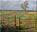
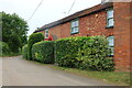
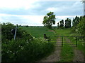
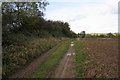

7 photos from this area
Area Information
Key information about the LU7 0DN including its size, population, and administrative classification.
- Area Type
- Postcode
- Area Size
- 1.8 km²
- Population
- 1825
- Population Density
- 89 people/km²
House Prices in LU7 0DN
25
Properties
£607,400
Average Sold Price
£10,600
Lowest Price
£1,325,000
Highest Price
Showing 25 properties
| Address | Type | Beds | Baths | Last Sale Price | Last Sale Date | |
|---|---|---|---|---|---|---|
| Sunny Lodge, Hollingdon Road, Soulbury, LU7 0DN | Bungalow | 4 | 4 | £950,000 | Jan 2025 | |
| Upper Hollingdon Farm, Hollingdon Road, Soulbury, LU7 0DN | Detached | 5 | 4 | £950,000 | Jun 2022 | |
| Willow Barn, Hollingdon Road, Soulbury, LU7 0DN | Bungalow | - | - | £470,000 | Jun 2021 | |
| Hazel Cottage, Hollingdon Road, Soulbury, LU7 0DN | Semi-detached | 4 | 3 | £461,000 | Feb 2021 | |
| Holly Bar Cottage, Hollingdon Road, Soulbury, LU7 0DN | Semi-detached | - | - | £10,600 | Jun 2016 | |
| Corner Croft, Hollingdon Road, Soulbury, LU7 0DN | Bungalow | 4 | - | £485,000 | Dec 2013 | |
| Littlemead, Hollingdon Road, Soulbury, LU7 0DN | Detached | 5 | 4 | £490,000 | Jun 2002 | |
| Hollingdon Grange, Grove Farm Lane, Hollingdon, Soulbury, LU7 0DN | Detached | - | - | £1,325,000 | Mar 2002 | |
| The Homestead, Hollingdon Road, Soulbury, LU7 0DN | Detached | - | - | £325,000 | Mar 1998 | |
| Casimir, Hollingdon Road, Soulbury, LU7 0DN | Detached | 5 | 4 | - | - |
Page 1 of 3
Energy Efficiency in LU7 0DN
Amenities
Schools
| Rank | School | Type | Entry gender | Ages |
|---|
Explore more schools in this area
Go to Schools tabDemographics
Household Size
Two person
most common
Accommodation Type
Houses
most common
Tenure
80
majority
Ethnic Group
White
most common
Religion
N/A
most common
Household Composition
N/A
most common
Age
47
median
Adults (30-64 years)
most common
Household Deprivation
N/A
with no deprivation
NS-SEC
46
in Lower managerial occupations
Explore more demographic insights in this area
Go to Demographics tabPlanning
Planning Constraints
- Flood RiskPremium
- Ramsar Wetland SitesPremium
- Area of Outstanding Natural BeautyPremium
- Protected Nature ReservePremium
- Protected WoodlandPremium