Area Overview for Lower Upnor
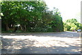
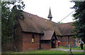
Photos of Lower Upnor


Area Information
Living in Lower Upnor means settling into a built-up area that spans 24.6 hectares. This location in England offers a distinct residential footprint, substantial enough to foster community ties yet compact enough to maintain manageable distances between homes. The character of the neighbourhood is defined by its status as a town or city district, providing a sense of place that differs from untouched rural villages. You are entering an environment where daily life revolves around immediate access to established services and transport links. The area does not boast vast expanses of land, but it delivers a concentrated living experience where proximity matters. Families and individuals seeking a grounded location will find the scale of Lower Upnor suits a steady rhythm of daily routines without the isolation of more remote settlements.
- Area Type
- Built Up Area 250
- Area Size
- 24.6 hectares
- Population
- Not available
- Population Density
- Not available
Your daily lifestyle in Lower Upnor benefits from practical amenities located within reasonable travel distance. For retail needs, you have five key options nearby, including the Spar and Co-op Chatham shop for necessities, alongside the M&S Chatham store for larger shopping trips. These outlets provide the essential goods you need without requiring a journey into a major city centre. Transport links are equally functional, offering five nearby railway stations: Strood Railway Station, Rochester Railway Station, and Gillingham Railway Station. These connections allow you to travel further afield for work or leisure with ease. Additionally, Rochester Airport sits just one station away, providing direct regional access for those needing to fly domestically. While local parks and leisure facilities are not explicitly listed in the immediate vicinity data, the proximity to major transport hubs ensures you can quickly reach broader recreational offerings in neighbouring towns. Your routine revolves around efficiency, with shops and stations forming the backbone of your weekly planning.
Amenities
Schools
| Rank | School | Type | Entry gender | Ages |
|---|
Explore more schools in this area
Go to Schools tabDemographics
The community in Lower Upnor reflects a settled population with significant life experience. The median age for residents is 70 years, indicating an area dominated by older home owners who have lived in their properties for decades. You will find that the vast majority of households fall into older age brackets, creating a demographic profile focused on stability rather than rapid turnover. Around 68 per cent of residences are owned outright or with a mortgage, demonstrating that residents have made a long-term commitment to this locality. This high rate of ownership contrasts with younger regions where rental flats often predominate. While the data does not detail specific ethnic or religious breakdowns, the age structure paints a clear picture of a mature community. The household composition largely mirrors this age profile, suggesting few young children live here. The area functions as a haven for the retired rather than a hub for young families or students.
Household Size
Accommodation Type
Tenure
Ethnic Group
Religion
Household Composition
Age
Household Deprivation
NS-SEC
Explore more demographic insights in this area
Go to Demographics tabPlanning
Planning Constraints
- Crime RiskPremium