Area Overview for Lower Beeding
Photos of Lower Beeding

Area Information
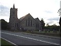
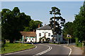
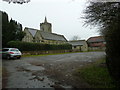
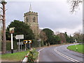
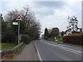
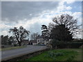
Lower Beeding stands as a defined built-up area within the wider landscape of West Sussex, England. The settlement covers a specific footprint of 29.4 hectares, creating a compact living environment distinct from surrounding open countryside. Residents here experience daily life characterised by proximity to friendly towns and access to reliable rail links. You will find that locations such as this offer a tangible sense of place rather than an anonymous suburb. The area functions as a residential cluster where commuting residents and long-time locals interact within a manageable space. Living in Lower Beeding means navigating a specific set of local conditions defined by its physical boundaries and administrative status as a built-up area. The community benefits from nearby stations like Horsham Railway Station, Faygate Railway Station, and Littlehaven Railway Station, which integrate the locale into regional transport networks. This connectivity is vital for those who rely on public transit or plan to drive to larger supermarkets such as Tesco Horsham or Budgens Handcross. The area does not try to hide its scale; it is a modestly sized settlement designed for those who prefer a quieter existence near larger service centres. You receive substantial advantages in terms of travel links while avoiding the density of major urban centres. The proximity to these key amenities ensures that you do not have to travel far for essential goods or transport options.
- Area Type
- Built Up Area 250
- Area Size
- 29.4 hectares
- Population
- Not available
- Population Density
- Not available
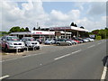
Residents of Lower Beeding gain access to a curated selection of amenities within practical reach without needing to travel deep into the city. The nearby retail sector includes five key outlets, with Spar, Tesco Horsham, and Budgens Handcross listed as notable providers. Tesco Horsham offers a comprehensive range of groceries, while Budgens Handcross provides a slightly smaller but still full service hypermarket option. You do not need to enter a dense urban high street for your weekly shopping; these superstores in adjacent towns serve the village effectively. These venues provide everything from fresh produce to household essentials, making the village feel self-contained for many daily tasks. Transport amenities are equally convenient, with five rail stations identified as accessible neighbours. Horsham Railway Station acts as the primary hub, offering fast rail services, while Faygate and Littlehaven stations provide alternative options for different commute routes. This network ensures that you can leave Lower Beeding quickly for work or leisure. The blend of these retail and transport nodes means that daily life does not require a car for every outing, although owning one remains practical for reaching these neighbouring towns. You will find that the character of daily life revolves around these accessible service points, allowing you to maintain a village lifestyle while enjoying the convenience of a larger shopping experience just minutes away.
Amenities
Schools
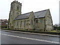
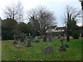
Education options immediately surrounding Lower Beeding are limited but include a specific institution that serves local families. Holy Trinity CofE Primary School, Lower Beeding is the only primary school listed in the data for this area. The school holds a good Ofsted rating, which is the highest designation available for English schools and often translates to high academic standards and attentive teaching. You should note that this is a Church of England primary institution, which may appeal to families wishing to enrol their children in a faith-based educational environment. The data does not list any secondary schools directly in Lower Beeding, meaning older children must travel to nearby towns for secondary education. The presence of a single primary school with a good rating suggests that the village supports young families looking for religious education alongside their children's primary years. If you are viewing schools near Lower Beeding, Holy Trinity represents the closest formal educational facility for the younger cohort. Families with school-age children constitute a smaller portion of the demographic given the high median age, yet the school's presence provides a vital family amenity. The arrangement allows younger residents to access maintained education while older residents maintain their independence and ownership of larger properties in the area.
| Rank | School | Type | Entry gender | Ages |
|---|
Explore more schools in this area
Go to Schools tabDemographics
The community profile of Lower Beeding reflects a settlement with clearly defined age characteristics. The median age within the area is 70 years, placing it firmly in the category of older residents compared to the national average. This demographic statistic indicates that the neighbourhood functions primarily as a retirement destination or a locality settled by families with elderly members. You are looking at a population where the most common age grouping relates to the total cohort, suggesting a broad spread but with a strong skew toward older adults. This age profile influences the local pace of life and the types of retail needs that develop in surrounding towns. Home ownership stands at 77% within Lower Beeding, a figure that highlights the stability of the resident base. You will find that the vast majority of people in these homes in Lower Beeding have purchased their property rather than renting accommodation. This high level of ownership often correlates with longer-term residents who have stayed put for decades or generations. The accommodation classification data remains general, though the ownership rate suggests a shift away from high-density rental blocks toward detached or semi-detached properties typical of this region. The demographic landscape is consistent with other established villages in West Sussex where property was passed down or retained over time. When considering schools near Lower Beeding, you note that families with school-aged children are likely a smaller subset of the overall population compared to areas with a younger median age.
Household Size
Accommodation Type
Tenure
Ethnic Group
Religion
Household Composition
Age
Household Deprivation
NS-SEC
Explore more demographic insights in this area
Go to Demographics tabPlanning
Planning Constraints
- Crime RiskPremium