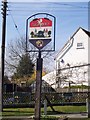
Area Overview for Langley Heath
Photos of Langley Heath


Area Information
Langley Heath is a compact built-up area in England covering 33.9 hectares, designed for those seeking a blend of practicality and accessibility. With a median age of 70, the population reflects a mature demographic, suggesting a community with established roots. The area’s home ownership rate of 79% indicates a stable, long-term resident base. Daily life here is shaped by proximity to essential services, including five retail outlets such as Aldi Langley and Morrisons Daily, and five nearby railway stations, including Hollingbourne and Bearsted. These connections make Langley Heath suitable for commuters and those prioritising convenience. The low crime risk score of 75, placing it below average for safety, adds to its appeal. While the area’s size is modest, its infrastructure ensures residents can access shops, transport, and leisure options without long commutes. For buyers, Langley Heath offers a quiet, well-connected environment with a focus on practical living, ideal for those valuing security and accessibility over sprawling urban amenities.
- Area Type
- Built Up Area 250
- Area Size
- 33.9 hectares
- Population
- Not available
- Population Density
- Not available
Langley Heath offers a range of amenities within practical reach, enhancing daily life for residents. The area includes five retail outlets, such as Aldi Langley, Morrisons Daily, and Co-op Maidstone, providing access to essential shopping and grocery needs. Nearby railway stations, including Hollingbourne, Bearsted, and Harrietsham, facilitate easy travel to surrounding towns and cities, supporting both work and leisure activities. While the data does not specify parks or recreational facilities, the presence of multiple retail and transport options suggests a focus on convenience over expansive green spaces. The character of the area is defined by its accessibility and the availability of basic services, making it ideal for those who prioritise ease of movement and proximity to essential amenities. For residents, this means a lifestyle that balances practicality with the ability to engage with broader regional networks.
Amenities
Schools
| Rank | School | Type | Entry gender | Ages |
|---|
Explore more schools in this area
Go to Schools tabDemographics
Langley Heath’s population is predominantly composed of individuals aged 70, with the most common age range encompassing the total population. This suggests a community with a significant proportion of older residents, which may influence local services and social dynamics. The high home ownership rate of 79% indicates that most residents live in properties they own, rather than renting. However, the data does not specify the types of households or accommodation, so assumptions about family structures or housing stock cannot be made. The area’s demographic profile, while lacking granular details on ethnicity or religion, aligns with broader trends of mature populations in smaller built-up areas. For quality of life, the stability of home ownership and the safety score of 75 suggest a low-risk environment, though the absence of specific diversity metrics means the community’s cultural or social composition remains undefined by the available data.
Household Size
Accommodation Type
Tenure
Ethnic Group
Religion
Household Composition
Age
Household Deprivation
NS-SEC
Explore more demographic insights in this area
Go to Demographics tabPlanning
Planning Constraints
- Crime RiskPremium