Area Overview for KT8 9XB
Photos of KT8 9XB


Area Information
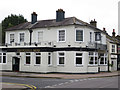
KT8 9XB is a small, tightly knit residential postcode in England with a population of 1443. It is a compact area where daily life is shaped by proximity to key transport hubs and retail centres. The community is predominantly composed of adults aged 30-64, reflecting a mature demographic with strong home ownership. Living here means access to multiple railway stations, including Hampton Court and Thames Ditton, as well as ferry services to Moulsey and Hampton. The area’s proximity to London Heathrow Airport ensures easy travel for commuters and frequent flyers. With 80% of residents owning their homes, the area has a stable, settled feel. Neighbourhoods are characterised by traditional housing stock, and the low crime risk score of 76 adds to the sense of security. For those prioritising connectivity, broadband scores reach 100, making remote work and digital lifestyles seamless. KT8 9XB is ideal for those seeking a balance between suburban tranquillity and urban accessibility, with amenities within practical reach.
- Area Type
- Postcode
- Area Size
- Not available
- Population
- 1443
- Population Density
- 2689 people/km²
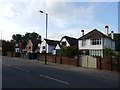
KT8 9XB is predominantly an owner-occupied area, with 80% of residents living in homes they own. The accommodation type is houses, which is unusual in many urban areas and suggests a more suburban or semi-rural character. This housing stock may appeal to those seeking private, stable living arrangements rather than rental properties. The small size of the postcode means the property market is limited in scope, with few options available within the immediate area. Buyers may need to consider nearby postcodes or surrounding regions for more variety. The high home ownership rate indicates a community with long-term residents, which can influence property values and local amenities. For those prioritising family homes, the presence of houses in KT8 9XB may be a key draw. However, the limited size of the area means competition for properties could be fierce, requiring buyers to act decisively when opportunities arise.
House Prices in KT8 9XB
No properties found in this postcode.
Energy Efficiency in KT8 9XB
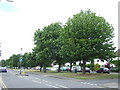
Living in KT8 9XB provides access to a range of amenities within short distances. Retail options include Tesco West, Sainsburys West Molesey, and Tesco East, offering everyday shopping needs. The area is served by five railway stations, including Hampton and Thames Ditton, as well as metro stops at Hounslow Central and Hounslow West, ensuring convenient travel. Ferry services to Moulsey and Hampton Court Pier add to the local transport diversity. Proximity to London Heathrow Airport makes the area attractive for those with travel-related jobs or frequent flyers. The presence of Heathrow Central Bus Station further enhances connectivity. While specific parks or leisure facilities are not detailed in the data, the area’s transport links suggest access to nearby green spaces and recreational areas. The combination of retail, transport, and travel options creates a lifestyle that balances convenience with suburban comfort, ideal for those prioritising accessibility and practicality.
Amenities
Schools
| Rank | School | Type | Entry gender | Ages |
|---|
Explore more schools in this area
Go to Schools tabDemographics
The population of KT8 9XB is 1443, with a median age of 47. The most common age group is adults aged 30-64, indicating a mature, established community. Home ownership is high at 80%, suggesting long-term residency and financial stability. The predominant accommodation type is houses, reflecting a traditional, family-oriented housing stock. The predominant ethnic group is White, though specific diversity metrics are not provided. This demographic profile implies a community focused on stability and continuity. The absence of specific data on deprivation or socioeconomic diversity means the area’s quality of life is inferred from its low crime risk and strong connectivity. With 80% of residents owning their homes, the area likely benefits from shared community values and reduced rental market pressures. The age range also suggests a population well-positioned for retirement or long-term settlement, with limited presence of younger or older age groups.
Household Size
Accommodation Type
Tenure
Ethnic Group
Religion
Household Composition
Age
Household Deprivation
NS-SEC
Explore more demographic insights in this area
Go to Demographics tabPlanning
Planning Constraints
- Flood RiskPremium
- Ramsar Wetland SitesPremium
- Area of Outstanding Natural BeautyPremium
- Protected Nature ReservePremium
- Protected WoodlandPremium