Area Overview for KT8 1TW
Photos of KT8 1TW

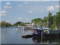
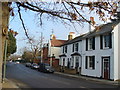
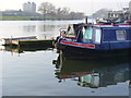

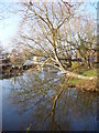
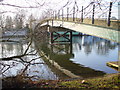
100 photos from this area
Area Information
Key information about the KT8 1TW including its size, population, and administrative classification.
- Area Type
- Postcode
- Area Size
- 4.4 hectares
- Population
- 1443
- Population Density
- 2689 people/km²
House Prices in KT8 1TW
33
Properties
£353,791
Average Sold Price
£1,000
Lowest Price
£625,000
Highest Price
Showing 33 properties
| Address | Type | Beds | Baths | Last Sale Price | Last Sale Date | |
|---|---|---|---|---|---|---|
| 146 Buckingham Gardens, West Molesey, KT8 1TW | house | 3 | 1 | £625,000 | Sep 2022 | |
| 145 Buckingham Gardens, West Molesey, KT8 1TW | house | - | - | £587,750 | Dec 2021 | |
| 137 Buckingham Gardens, West Molesey, KT8 1TW | house | - | - | £1,000 | Dec 2019 | |
| 125 Buckingham Gardens, West Molesey, KT8 1TW | Terraced | 3 | - | £468,000 | Apr 2019 | |
| 143 Buckingham Gardens, West Molesey, KT8 1TW | Terraced | 4 | 2 | £550,000 | Jun 2017 | |
| 124 Buckingham Gardens, West Molesey, KT8 1TW | Terraced | 3 | 1 | £394,950 | Apr 2015 | |
| 139 Buckingham Gardens, West Molesey, KT8 1TW | Terraced | - | - | £375,000 | Apr 2009 | |
| 127 Buckingham Gardens, West Molesey, KT8 1TW | Terraced | - | - | £260,000 | Jan 2006 | |
| 126 Buckingham Gardens, West Molesey, KT8 1TW | house | - | - | £215,000 | Nov 2003 | |
| 140 Buckingham Gardens, West Molesey, KT8 1TW | Terraced | - | - | £280,000 | Nov 2002 |
Page 1 of 4
Energy Efficiency in KT8 1TW
Amenities
Schools
| Rank | School | Type | Entry gender | Ages |
|---|
Explore more schools in this area
Go to Schools tabDemographics
Household Size
Family (3-5 people)
most common
Accommodation Type
Houses
most common
Tenure
80
majority
Ethnic Group
White
most common
Religion
N/A
most common
Household Composition
N/A
most common
Age
47
median
Adults (30-64 years)
most common
Household Deprivation
N/A
with no deprivation
NS-SEC
47
in Lower managerial occupations
Explore more demographic insights in this area
Go to Demographics tabPlanning
Planning Constraints
- Flood RiskPremium
- Ramsar Wetland SitesPremium
- Area of Outstanding Natural BeautyPremium
- Protected Nature ReservePremium
- Protected WoodlandPremium