Area Overview for KT8 1PD
Photos of KT8 1PD
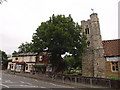
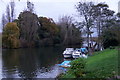
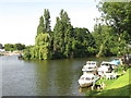
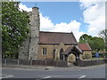
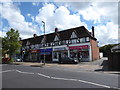
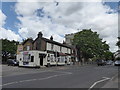
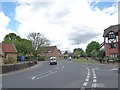
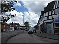
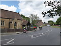
55 photos from this area
Area Information
Key information about the KT8 1PD including its size, population, and administrative classification.
- Area Type
- Postcode
- Area Size
- 3.4 hectares
- Population
- 1443
- Population Density
- 2689 people/km²
House Prices in KT8 1PD
31
Properties
£578,682
Average Sold Price
£340,000
Lowest Price
£935,000
Highest Price
Showing 31 properties
| Address | Type | Beds | Baths | Last Sale Price | Last Sale Date | |
|---|---|---|---|---|---|---|
| 14 Dunstall Way, West Molesey, KT8 1PD | Detached | 3 | 2 | £875,000 | Jul 2025 | |
| 21 Dunstall Way, West Molesey, KT8 1PD | house | - | - | £715,000 | Jan 2025 | |
| 18 Dunstall Way, West Molesey, KT8 1PD | Semi-detached | 4 | 3 | £935,000 | Mar 2024 | |
| 8 Dunstall Way, West Molesey, KT8 1PD | house | - | - | £705,000 | Dec 2021 | |
| 24 Dunstall Way, West Molesey, KT8 1PD | house | - | - | £650,000 | Sep 2021 | |
| 29 Dunstall Way, West Molesey, KT8 1PD | Semi-detached | 4 | - | £712,500 | Mar 2017 | |
| 19 Dunstall Way, West Molesey, KT8 1PD | Semi-detached | - | - | £345,000 | Sep 2007 | |
| 2 Dunstall Way, West Molesey, KT8 1PD | Semi-detached | 5 | 3 | £350,000 | Sep 2007 | |
| 9 Dunstall Way, West Molesey, KT8 1PD | Semi-detached | - | - | £340,000 | Aug 2005 | |
| 28 Dunstall Way, West Molesey, KT8 1PD | Semi-detached | - | - | £375,000 | Sep 2003 |
Page 1 of 4
Energy Efficiency in KT8 1PD
Amenities
Schools
| Rank | School | Type | Entry gender | Ages |
|---|
Explore more schools in this area
Go to Schools tabDemographics
Household Size
Family (3-5 people)
most common
Accommodation Type
Houses
most common
Tenure
80
majority
Ethnic Group
White
most common
Religion
N/A
most common
Household Composition
N/A
most common
Age
47
median
Adults (30-64 years)
most common
Household Deprivation
N/A
with no deprivation
NS-SEC
47
in Lower managerial occupations
Explore more demographic insights in this area
Go to Demographics tabPlanning
Planning Constraints
- Flood RiskPremium
- Ramsar Wetland SitesPremium
- Area of Outstanding Natural BeautyPremium
- Protected Nature ReservePremium
- Protected WoodlandPremium