Area Overview for KT7 0TR
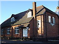
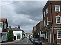
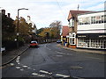
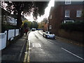
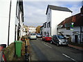
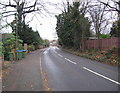
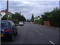
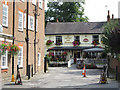
Photos of KT7 0TR


Area Information
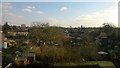
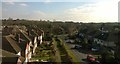
KT7 0TR is a small, tightly knit residential postcode area in England, home to 1,797 people. It is a modest cluster of properties, primarily houses, with a median age of 47 and a population skewed toward adults aged 30–64. This suggests a mature, stable community where many residents are likely to be long-term homeowners. The area’s compact size means it is not sprawling, but it offers a quiet, low-density living environment. Proximity to Thames Ditton Infant School, with a good Ofsted rating, adds to its appeal for families. Digital connectivity is strong, with a broadband score of 99 and mobile coverage rated 85, ensuring seamless internet use for work or leisure. The area’s transport links are varied, with nearby rail stations, ferry landings, and tram stops providing easy access to surrounding towns. While KT7 0TR lacks major urban amenities, its small-scale charm and practical infrastructure make it a viable choice for those seeking a balanced lifestyle.
- Area Type
- Postcode
- Area Size
- Not available
- Population
- 1797
- Population Density
- 4403 people/km²
KT7 0TR is predominantly an owner-occupied area, with 76% of homes owned by residents rather than rented. The accommodation type is primarily houses, which is unusual for many urban postcode areas. This suggests a market focused on family homes and long-term investment rather than rental properties. The small size of the area means the housing stock is limited, which could make the property market competitive for buyers. However, the high home ownership rate indicates strong local demand and stability. For buyers, this means a potentially reliable market with established properties, though the limited number of homes may require a broader search in nearby areas. The absence of flats or apartments also suggests a preference for single-family living, which could appeal to specific buyer profiles.
House Prices in KT7 0TR
No properties found in this postcode.
Energy Efficiency in KT7 0TR
KT7 0TR offers a range of amenities within practical reach. Retail options include Budgens High, Co-op Thames, and Budgens Manor, providing everyday shopping needs. The area’s ferry landings, such as Hampton Court Pier and Kingston Town End Pier, offer access to water-based leisure activities. Rail stations like Thames Ditton and Hinchley Wood, along with metro stops such as Morden and Merton Park Tram Stop, ensure easy travel to nearby towns and cities. While the area lacks large parks or cultural venues, its proximity to Thames Ditton and surrounding suburbs provides access to green spaces and recreational opportunities. The mix of retail, transport, and water-based amenities contributes to a convenient, low-maintenance lifestyle, ideal for those prioritising accessibility over sprawling urban facilities.
Amenities
Schools
The nearest school to KT7 0TR is Thames Ditton Infant School, a primary school with a good Ofsted rating. This school serves the area’s younger residents, offering a solid foundation for early education. The presence of a primary school with a good rating is a key draw for families, though the data does not list secondary schools in the immediate vicinity. This means parents may need to look beyond KT7 0TR for secondary education options. The school’s rating indicates a focus on quality teaching and facilities, which is reassuring for families prioritising education. However, the lack of secondary schools nearby could be a consideration for those requiring a full range of educational services within the area.
| Rank | School | Type | Entry gender | Ages |
|---|
Explore more schools in this area
Go to Schools tabDemographics
The population of KT7 0TR is 1,797, with a median age of 47. The majority of residents are adults aged 30–64, indicating a mature demographic profile. Home ownership is high at 76%, with houses being the predominant type of accommodation. The predominant ethnic group is White, though specific diversity statistics are not provided. This age group and ownership rate suggest a community with established households and limited turnover. The absence of detailed data on deprivation or household composition means the area’s socioeconomic diversity remains unquantified, but the high home ownership rate implies a relatively stable financial environment. For those considering KT7 0TR, the demographic profile aligns with a quiet, settled neighbourhood where long-term residency is common.
Household Size
Accommodation Type
Tenure
Ethnic Group
Religion
Household Composition
Age
Household Deprivation
NS-SEC
Explore more demographic insights in this area
Go to Demographics tabPlanning
Planning Constraints
- Flood RiskPremium
- Ramsar Wetland SitesPremium
- Area of Outstanding Natural BeautyPremium
- Protected Nature ReservePremium
- Protected WoodlandPremium