Area Overview for KT7 0SF
Photos of KT7 0SF
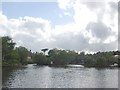
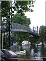
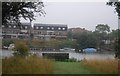
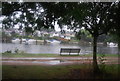
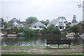
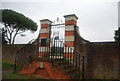
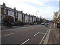
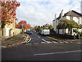
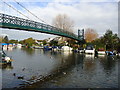
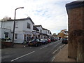

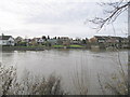
100 photos from this area
Area Information
Key information about the KT7 0SF including its size, population, and administrative classification.
- Area Type
- Postcode
- Area Size
- 6224 m²
- Population
- 1797
- Population Density
- 4403 people/km²
House Prices in KT7 0SF
36
Properties
£574,445
Average Sold Price
£172,000
Lowest Price
£1,225,000
Highest Price
Showing 36 properties
| Address | Type | Beds | Baths | Last Sale Price | Last Sale Date | |
|---|---|---|---|---|---|---|
| Skyview, High Street, Thames Ditton, KT7 0SF | house | 4 | 4 | £1,080,000 | Sep 2021 | |
| 95 High Street, Thames Ditton, KT7 0SF | Detached | 5 | 3 | £1,225,000 | Oct 2018 | |
| 67 High Street, Thames Ditton, KT7 0SF | Terraced | 2 | 1 | £579,950 | Dec 2014 | |
| 81 High Street, Thames Ditton, KT7 0SF | house | - | - | £765,000 | Nov 2014 | |
| 69 High Street, Thames Ditton, KT7 0SF | house | - | - | £470,000 | Jul 2011 | |
| 53B High Street, Thames Ditton, KT7 0SF | Flat | - | - | £220,000 | Apr 2011 | |
| 83 High Street, Thames Ditton, KT7 0SF | house | 3 | - | £555,000 | Sep 2010 | |
| 97 High Street, Thames Ditton, KT7 0SF | house | 4 | - | £302,500 | Apr 2005 | |
| 63 High Street, Thames Ditton, KT7 0SF | house | - | - | £375,000 | Jan 2005 | |
| 71 High Street, Thames Ditton, KT7 0SF | Terraced | 1 | 1 | £172,000 | Jan 1999 |
Page 1 of 4
Energy Efficiency in KT7 0SF
Amenities
Schools
| Rank | School | Type | Entry gender | Ages |
|---|
Explore more schools in this area
Go to Schools tabDemographics
Household Size
Family (3-5 people)
most common
Accommodation Type
Houses
most common
Tenure
76
majority
Ethnic Group
White
most common
Religion
N/A
most common
Household Composition
N/A
most common
Age
47
median
Adults (30-64 years)
most common
Household Deprivation
N/A
with no deprivation
NS-SEC
60
in Lower managerial occupations
Explore more demographic insights in this area
Go to Demographics tabPlanning
Planning Constraints
- Flood RiskPremium
- Ramsar Wetland SitesPremium
- Area of Outstanding Natural BeautyPremium
- Protected Nature ReservePremium
- Protected WoodlandPremium