Area Overview for KT6 5EY
Photos of KT6 5EY


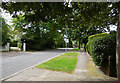
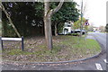
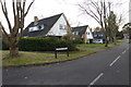


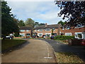
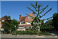

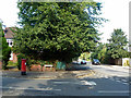
26 photos from this area
Area Information
Key information about the KT6 5EY including its size, population, and administrative classification.
- Area Type
- Postcode
- Area Size
- 4.1 hectares
- Population
- 1378
- Population Density
- 3245 people/km²
House Prices in KT6 5EY
67
Properties
£922,571
Average Sold Price
£675,000
Lowest Price
£1,550,000
Highest Price
Showing 67 properties
| Address | Type | Beds | Baths | Last Sale Price | Last Sale Date | |
|---|---|---|---|---|---|---|
| Heron House, 18 St Marys Road, Long Ditton, Surbiton, KT6 5EY | Detached | 3 | 1 | £980,000 | Jun 2023 | |
| Bay Tree House, 12 St Marys Road, Long Ditton, Surbiton, KT6 5EY | Detached | 3 | 3 | £1,550,000 | Jul 2020 | |
| 54 St Marys Road, Long Ditton, Surbiton, KT6 5EY | house | - | - | £675,000 | Aug 2009 | |
| 50 St Marys Road, Long Ditton, Surbiton, KT6 5EY | house | 5 | - | £970,000 | Jul 2009 | |
| 52 St Marys Road, Long Ditton, Surbiton, KT6 5EY | house | - | - | £710,000 | Apr 2008 | |
| 68 St Marys Road, Long Ditton, Surbiton, KT6 5EY | Detached | 5 | 3 | £753,000 | Dec 2003 | |
| 48 St Marys Road, Long Ditton, Surbiton, KT6 5EY | Detached | - | - | £820,000 | Jun 2001 | |
| Flat 4, Tilia House, 32 St Marys Road, Long Ditton, Surbiton, KT6 5EY | Flat | 2 | 2 | - | - | |
| Flat 1, 34 St Marys Road, Long Ditton, Surbiton, KT6 5EY | Flat | 2 | 1 | - | - | |
| Flat 6, Tilia House, 32 St Marys Road, Long Ditton, Surbiton, KT6 5EY | Flat | 1 | 1 | - | - |
Page 1 of 7
Energy Efficiency in KT6 5EY
Amenities
Schools
| Rank | School | Type | Entry gender | Ages |
|---|
Explore more schools in this area
Go to Schools tabDemographics
Household Size
Family (3-5 people)
most common
Accommodation Type
Houses
most common
Tenure
81
majority
Ethnic Group
White
most common
Religion
N/A
most common
Household Composition
N/A
most common
Age
47
median
Adults (30-64 years)
most common
Household Deprivation
N/A
with no deprivation
NS-SEC
58
in Lower managerial occupations
Explore more demographic insights in this area
Go to Demographics tabPlanning
Planning Constraints
- Flood RiskPremium
- Ramsar Wetland SitesPremium
- Area of Outstanding Natural BeautyPremium
- Protected Nature ReservePremium
- Protected WoodlandPremium