Area Overview for KT4 7WG
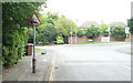
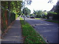
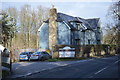
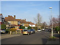
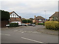
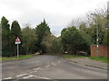
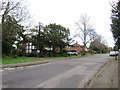
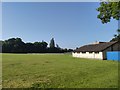
Photos of KT4 7WG

Area Information
KT4 7WG is a small, tightly knit residential area in England with a population of 1,545. Its compact size fosters a close-knit community, where daily life is shaped by proximity to amenities and a balanced mix of local and regional connectivity. The area is characterised by a predominantly older demographic, with a median age of 47 and most residents falling within the 30–64 age range. This suggests a stable population of professionals, families, and retirees. The area’s housing stock is largely composed of houses, reflecting a preference for private, family-oriented living. Residents benefit from low crime rates, with a safety score of 92, and minimal environmental risks, including no flood zones or protected natural areas. KT4 7WG is well-served by transport options, from rail stations to ferry landings, making it accessible for commuters. Its blend of safety, convenience, and community character makes it an attractive option for those seeking a settled, low-stress lifestyle in a small, well-connected postcode.
- Area Type
- Postcode
- Area Size
- Not available
- Population
- 1545
- Population Density
- 4748 people/km²
The property market in KT4 7WG is characterised by a high rate of home ownership (63%) and a predominance of houses over flats or apartments. This indicates a market skewed towards owner-occupied properties, likely attracting families and professionals seeking private, spacious living. The focus on houses suggests a demand for larger homes with gardens, which may appeal to those prioritising comfort and family-friendly environments. Given the area’s small size, the housing stock is limited, meaning buyers may need to consider nearby postcode areas for more options. The relatively high home ownership rate also implies a stable market with long-term residents, reducing turnover and fostering a sense of community. For buyers, this means a focus on existing properties rather than new developments, with potential for value retention in a low-risk, well-maintained housing stock.
House Prices in KT4 7WG
No properties found in this postcode.
Energy Efficiency in KT4 7WG
Living in KT4 7WG offers access to a range of amenities that support daily life. Retail options include major supermarkets like Waitrose, Iceland, and Tesco, ensuring convenience for shopping. The area’s proximity to rail stations such as Worcester Park and Malden Manor, as well as metro stops like Morden and Dundonald Road, facilitates easy travel for work or leisure. Ferry landings at Kingston Town End Pier and Ditton Island provide additional transport links, particularly for those near waterways. While the area itself is small, its surrounding regions offer more extensive leisure and dining options. The presence of multiple retail and transport hubs within practical reach suggests a lifestyle that balances local convenience with regional accessibility, making it suitable for those who value both autonomy and connectivity.
Amenities
Schools
| Rank | School | Type | Entry gender | Ages |
|---|
Explore more schools in this area
Go to Schools tabDemographics
The community in KT4 7WG is predominantly composed of adults aged 30–64, with a median age of 47. This age range indicates a population largely in their prime working years, suggesting stability and a mix of established families and professionals. Home ownership is high, with 63% of residents owning their homes, reflecting a long-term commitment to the area. The accommodation type is primarily houses, which aligns with the demographic profile of older, settled households. The predominant ethnic group is White, though specific diversity data is not provided. The small population of 1,545 means the area is not densely populated, contributing to a quieter, more personal living environment. The absence of significant deprivation metrics implies that residents generally enjoy a moderate to high quality of life, supported by the area’s safety and accessibility. This profile suggests a community that values stability, privacy, and proximity to essential services.
Household Size
Accommodation Type
Tenure
Ethnic Group
Religion
Household Composition
Age
Household Deprivation
NS-SEC
Explore more demographic insights in this area
Go to Demographics tabPlanning
Planning Constraints
- Flood RiskPremium
- Ramsar Wetland SitesPremium
- Area of Outstanding Natural BeautyPremium
- Protected Nature ReservePremium
- Protected WoodlandPremium