Area Overview for KT4 7JT
Photos of KT4 7JT

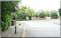
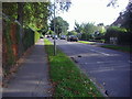
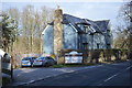
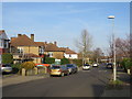
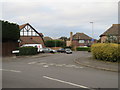
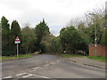
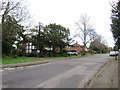
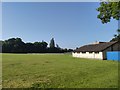
29 photos from this area
Area Information
Key information about the KT4 7JT including its size, population, and administrative classification.
- Area Type
- Postcode
- Area Size
- 3.3 hectares
- Population
- 1342
- Population Density
- 3146 people/km²
House Prices in KT4 7JT
28
Properties
£458,818
Average Sold Price
£183,000
Lowest Price
£730,000
Highest Price
Showing 28 properties
| Address | Type | Beds | Baths | Last Sale Price | Last Sale Date | |
|---|---|---|---|---|---|---|
| 16 Drumaline Ridge, Worcester Park, KT4 7JT | Detached | 3 | 1 | £696,000 | Jul 2022 | |
| 22 Drumaline Ridge, Worcester Park, KT4 7JT | Detached | 4 | 3 | £730,000 | Jul 2021 | |
| 20 Drumaline Ridge, Worcester Park, KT4 7JT | Detached | 4 | 1 | £510,000 | Sep 2019 | |
| 24 Drumaline Ridge, Worcester Park, KT4 7JT | house | - | - | £528,000 | Nov 2016 | |
| 28 Drumaline Ridge, Worcester Park, KT4 7JT | Detached | - | - | £590,000 | Dec 2015 | |
| 6 Drumaline Ridge, Worcester Park, KT4 7JT | Detached | 4 | - | £700,000 | Jun 2014 | |
| 23 Drumaline Ridge, Worcester Park, KT4 7JT | Detached | 4 | 1 | £425,000 | May 2013 | |
| 14 Drumaline Ridge, Worcester Park, KT4 7JT | house | 4 | 2 | £390,000 | Feb 2013 | |
| 5 Drumaline Ridge, Worcester Park, KT4 7JT | Detached | 4 | 2 | £499,950 | Apr 2006 | |
| 15 Drumaline Ridge, Worcester Park, KT4 7JT | Detached | - | - | £340,000 | Apr 2005 |
Page 1 of 3
Energy Efficiency in KT4 7JT
Amenities
Schools
| Rank | School | Type | Entry gender | Ages |
|---|
Explore more schools in this area
Go to Schools tabDemographics
Household Size
Family (3-5 people)
most common
Accommodation Type
Houses
most common
Tenure
86
majority
Ethnic Group
White
most common
Religion
N/A
most common
Household Composition
N/A
most common
Age
47
median
Adults (30-64 years)
most common
Household Deprivation
N/A
with no deprivation
NS-SEC
40
in Lower managerial occupations
Explore more demographic insights in this area
Go to Demographics tabPlanning
Planning Constraints
- Flood RiskPremium
- Ramsar Wetland SitesPremium
- Area of Outstanding Natural BeautyPremium
- Protected Nature ReservePremium
- Protected WoodlandPremium