Area Overview for KT24 6SR
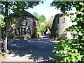
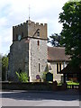
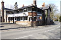
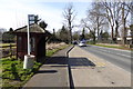
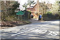
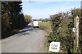
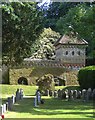
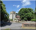
Photos of KT24 6SR
Area Information
Living in KT24 6SR offers a distinct experience defined by its specific residential character. This postcode covers a small cluster of homes with a total area size of 230 metres squared. The region holds a population of 1,446 residents, creating a compact community that feels intimate yet established. You will find a high concentration of people relative to the land, with a density of 1,327 people per square kilometre. This setting provides a quiet environment where daily life revolves around a close-knit group of neighbours rather than the anonymity of larger cities. The area functions as a self-contained neighbourhood where the scale of the population suggests a manageable pace of life. Prospective homebuyers should note that this is a mature location where thousands of residents call it home. The small footprint of the postcode means that local resources and community events likely have a direct impact on daily routines. You are part of a specific demographic profile, living among others who share similar life stages and housing preferences. The physical boundaries of the 230 metres squared zone shape how you interact with the immediate surroundings. Whether you are a current resident or a potential buyer, the environment is defined by these hard geographical facts and the stable community structure that has developed over time. It is a place where the population size ensures a sense of history without overwhelming density.
- Area Type
- Postcode
- Area Size
- 230 m²
- Population
- 1446
- Population Density
- 1327 people/km²
The property market in KT24 6SR is defined by a robust housing stock dominated by houses. A staggering 71% of residents own their homes, which signals that this postcode is not a hub for the rental market. Instead, the local economy revolves around long-term ownership and established families. This high ownership rate influences the character of the streets, as you are surrounded by people who have invested in their local gates and gardens. prospective buyers will find that the area consists almost entirely of houses, meaning the house price and property value are likely stable and reflective of a buy-to-live market. There are no indications of a surge in student accommodation or social housing within this specific cluster. The 71% figure represents a deal of residents who have stayed put, suggesting that properties hold their value through cycles of market fluctuation. If you are looking at homes in KT24 6SR, you are entering a market where sellers are owners, not landlords seeking a quick turnover. The accommodation type is strictly houses, so the market does not attract buyers looking for flats or maisonettes. This specific configuration is ideal for those who value space and security. The data confirms that this is a traditional family district where the priority is on securing a home to keep for the future. You will not find the dynamics of a student quarter or a commuter rental hotspot here.
House Prices in KT24 6SR
Showing 1 properties
| Address | Type | Beds | Baths | Last Sale Price | Last Sale Date | |
|---|---|---|---|---|---|---|
| 6 Bishopsmead Parade, East Horsley, KT24 6SR | shop | - | - | - | - |
Energy Efficiency in KT24 6SR
Living in KT24 6SR gives you easy access to a range of retail and transport amenities within practical reach. Your daily grocer will likely be one of the five notable outlets including Waitrose Little, Sainsburys East, or Co-op High. These stores ensure you can buy fresh food, household essentials, and even premium groceries without a long drive. The presence of Sainsburys East suggests good value options alongside the premium feel of Waitrose. Convenience is key here, and you will find that most standard shopping needs are located nearby. For those who prefer to walk to their local shops, these four venues provide a solid foundation for a self-sufficient lifestyle. Beyond shopping, your transport network is equally convenient. You have five railway stations nearby, specifically Horsley Railway Station, Effingham Junction Railway Station, and Bookham Railway Station. These stations act as your main artery to the wider region. You can catch trains to London Waterloo or Reading, making the area viable for commuters. The mix of retail and rail means you can combine a morning coffee from a local outlet with a quick train ride to work. You do not need to rely solely on your car for social trips or major errands. The layout allows you to manage your week with a simple trip to the local shops in the morning and a train ride in the evening. This balance makes life here efficient and enjoyable. You get the quiet of a residential zone with the practicality of being close to major services.
Amenities
Schools
| Rank | School | Type | Entry gender | Ages |
|---|
Explore more schools in this area
Go to Schools tabDemographics
The community in KT24 6SR is characterised by significant stability and maturity. The median age stands at 47 years, reflecting a neighbourhood dominated by adults between the ages of 30 and 64 years old. This age profile suggests a settled population likely focused on family life, career stability, or retirement planning rather than transient student housing or young professionals. Home ownership is extremely high at 71%, indicating that the vast majority of residents have purchased plutôt than rented their properties. This metric confirms that the area is a long-term investment destination for those seeking to stay rather than move frequently. Houses make up the predominant accommodation type, shaping the architectural landscape and garden spaces typical of the zone. The population is predominantly White, contributing to a relatively homogenous social fabric within this specific cluster. You can expect a neighbourly environment where long-term residents know one another well. The high rate of ownership supports local businesses, as homeowners are generally more likely to spend within their immediate community. Data confirms that this is not a transient area, but a place where people plant their roots. The demographic data paints a clear picture of a mature, property-owning society with a distinct lack of young families or students. Living here means joining a group where permanence is the norm.
Household Size
Accommodation Type
Tenure
Ethnic Group
Religion
Household Composition
Age
Household Deprivation
NS-SEC
Explore more demographic insights in this area
Go to Demographics tabPlanning
Planning Constraints
- Flood RiskPremium
- Ramsar Wetland SitesPremium
- Area of Outstanding Natural BeautyPremium
- Protected Nature ReservePremium
- Protected WoodlandPremium