Area Overview for KT24 6HS
Photos of KT24 6HS
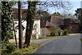
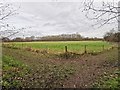
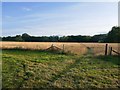
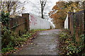
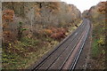
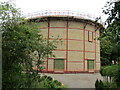
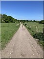
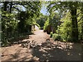
25 photos from this area
Area Information
Key information about the KT24 6HS including its size, population, and administrative classification.
- Area Type
- Postcode
- Area Size
- 37.5 hectares
- Population
- 1378
- Population Density
- 157 people/km²
House Prices in KT24 6HS
16
Properties
£819,917
Average Sold Price
£201,500
Lowest Price
£1,500,000
Highest Price
Showing 16 properties
| Address | Type | Beds | Baths | Last Sale Price | Last Sale Date | |
|---|---|---|---|---|---|---|
| 194 The Street, West Horsley, KT24 6HS | Detached | 4 | - | £1,500,000 | Apr 2022 | |
| 168 The Street, West Horsley, KT24 6HS | Detached | 4 | 3 | £1,110,000 | Nov 2021 | |
| Apple Tree Cottage, 200 The Street, West Horsley, KT24 6HS | house | 4 | - | £1,115,000 | Jul 2015 | |
| 182 The Street, West Horsley, KT24 6HS | house | 4 | - | £779,000 | Aug 2010 | |
| 188 The Street, West Horsley, KT24 6HS | Detached | - | - | £214,000 | Aug 1996 | |
| 186 The Street, West Horsley, KT24 6HS | house | - | - | £201,500 | Jun 1996 | |
| Hornbeam, 174 The Street, West Horsley, KT24 6HS | Detached | 3 | 1 | - | - | |
| The Laurels, 170 The Street, West Horsley, KT24 6HS | Detached | 4 | 2 | - | - | |
| Primrose Cottage, 192 The Street, West Horsley, KT24 6HS | Semi-detached | 3 | 1 | - | - | |
| The Barn At, Hornbeam, 174 The Street, West Horsley, KT24 6HS | Detached | 3 | 1 | - | - |
Page 1 of 2
Energy Efficiency in KT24 6HS
Amenities
Schools
| Rank | School | Type | Entry gender | Ages |
|---|
Explore more schools in this area
Go to Schools tabDemographics
Household Size
Family (3-5 people)
most common
Accommodation Type
Houses
most common
Tenure
84
majority
Ethnic Group
White
most common
Religion
N/A
most common
Household Composition
N/A
most common
Age
47
median
Adults (30-64 years)
most common
Household Deprivation
N/A
with no deprivation
NS-SEC
51
in Lower managerial occupations
Explore more demographic insights in this area
Go to Demographics tabPlanning
Planning Constraints
- Flood RiskPremium
- Ramsar Wetland SitesPremium
- Area of Outstanding Natural BeautyPremium
- Protected Nature ReservePremium
- Protected WoodlandPremium