Area Overview for KT24 6HQ
Photos of KT24 6HQ
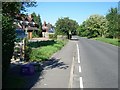
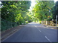
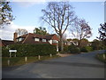
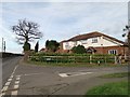
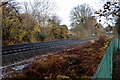
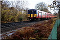
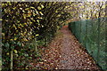
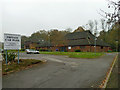

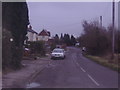
22 photos from this area
Area Information
Key information about the KT24 6HQ including its size, population, and administrative classification.
- Area Type
- Postcode
- Area Size
- 2.2 hectares
- Population
- 1554
- Population Density
- 754 people/km²
House Prices in KT24 6HQ
18
Properties
£674,045
Average Sold Price
£22,000
Lowest Price
£1,440,000
Highest Price
Showing 18 properties
| Address | Type | Beds | Baths | Last Sale Price | Last Sale Date | |
|---|---|---|---|---|---|---|
| 31 East Lane, West Horsley, KT24 6HQ | Detached | 4 | 3 | £1,050,000 | Nov 2022 | |
| Buxted House, 43 East Lane, West Horsley, KT24 6HQ | Detached | 4 | 2 | £950,000 | Jan 2021 | |
| 41 East Lane, West Horsley, KT24 6HQ | Bungalow | 5 | 3 | £860,000 | Nov 2020 | |
| 39 East Lane, West Horsley, KT24 6HQ | Bungalow | 3 | 1 | £690,000 | Apr 2020 | |
| Cavendish House, 27 East Lane, West Horsley, KT24 6HQ | Detached | 4 | 4 | £1,440,000 | May 2019 | |
| 23 East Lane, West Horsley, KT24 6HQ | Land | 3 | 1 | £22,000 | Nov 2018 | |
| Martindale, 35 East Lane, West Horsley, KT24 6HQ | house | 3 | - | £735,000 | Jun 2016 | |
| Tupelo, 33 East Lane, West Horsley, KT24 6HQ | Detached | 4 | 2 | £500,000 | Nov 2013 | |
| 47 East Lane, West Horsley, KT24 6HQ | house | 3 | - | £635,000 | Sep 2012 | |
| 49 East Lane, West Horsley, KT24 6HQ | Detached | - | - | £397,500 | Feb 2006 |
Page 1 of 2
Energy Efficiency in KT24 6HQ
Amenities
Schools
| Rank | School | Type | Entry gender | Ages |
|---|
Explore more schools in this area
Go to Schools tabDemographics
Household Size
Family (3-5 people)
most common
Accommodation Type
Houses
most common
Tenure
89
majority
Ethnic Group
White
most common
Religion
N/A
most common
Household Composition
N/A
most common
Age
47
median
Adults (30-64 years)
most common
Household Deprivation
N/A
with no deprivation
NS-SEC
53
in Lower managerial occupations
Explore more demographic insights in this area
Go to Demographics tabPlanning
Planning Constraints
- Flood RiskPremium
- Ramsar Wetland SitesPremium
- Area of Outstanding Natural BeautyPremium
- Protected Nature ReservePremium
- Protected WoodlandPremium