Area Overview for KT24 6AP
Photos of KT24 6AP
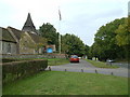
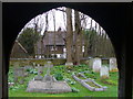
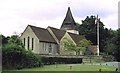
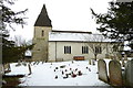
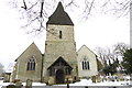
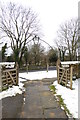
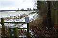
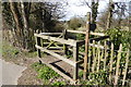
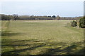
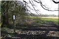
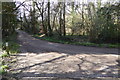
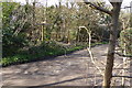
69 photos from this area
Area Information
Key information about the KT24 6AP including its size, population, and administrative classification.
- Area Type
- Postcode
- Area Size
- 42.7 hectares
- Population
- 1378
- Population Density
- 157 people/km²
House Prices in KT24 6AP
21
Properties
£1,034,167
Average Sold Price
£170,000
Lowest Price
£2,800,000
Highest Price
Showing 21 properties
| Address | Type | Beds | Baths | Last Sale Price | Last Sale Date | |
|---|---|---|---|---|---|---|
| Church House, Epsom Road, West Horsley, KT24 6AP | Detached | 4 | 2 | £1,250,000 | Nov 2023 | |
| Hazel Cottage, Epsom Road, West Horsley, KT24 6AP | Detached | 3 | 1 | £725,000 | Mar 2021 | |
| Bramley House, Epsom Road, West Horsley, KT24 6AP | house | - | - | £2,800,000 | Aug 2019 | |
| Leas View, Epsom Road, West Horsley, KT24 6AP | Detached | 3 | 2 | £830,000 | Oct 2016 | |
| Beech Rise, Epsom Road, West Horsley, KT24 6AP | Bungalow | - | - | £430,000 | May 2012 | |
| Burbank, Epsom Road, West Horsley, KT24 6AP | Detached | 4 | 3 | £170,000 | Aug 1997 | |
| Openview Farmhouse, Openview Farm, Epsom Road, West Horsley, KT24 6AP | Detached | - | - | - | - | |
| Unit 5, Openview Farm, Epsom Road, West Horsley, KT24 6AP | Industrial | - | - | - | - | |
| Milloe Soft Furnishings, Unit 4B, Openview Farm, Epsom Road, West Horsley, KT24 6AP | office_workshop | - | - | - | - | |
| Tia Limited, Unit 4A, Openview Farm, Epsom Road, West Horsley, KT24 6AP | office_workshop | - | - | - | - |
Page 1 of 3
Energy Efficiency in KT24 6AP
Amenities
Schools
| Rank | School | Type | Entry gender | Ages |
|---|
Explore more schools in this area
Go to Schools tabDemographics
Household Size
Family (3-5 people)
most common
Accommodation Type
Houses
most common
Tenure
84
majority
Ethnic Group
White
most common
Religion
N/A
most common
Household Composition
N/A
most common
Age
47
median
Adults (30-64 years)
most common
Household Deprivation
N/A
with no deprivation
NS-SEC
51
in Lower managerial occupations
Explore more demographic insights in this area
Go to Demographics tabPlanning
Planning Constraints
- Flood RiskPremium
- Ramsar Wetland SitesPremium
- Area of Outstanding Natural BeautyPremium
- Protected Nature ReservePremium
- Protected WoodlandPremium