Area Overview for KT22 9TX
Photos of KT22 9TX
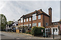
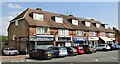
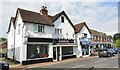
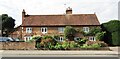
32 photos from this area
Area Information
Key information about the KT22 9TX including its size, population, and administrative classification.
- Area Type
- Postcode
- Area Size
- 1.8 hectares
- Population
- 1257
- Population Density
- 4099 people/km²
House Prices in KT22 9TX
31
Properties
£375,204
Average Sold Price
£192,500
Lowest Price
£635,000
Highest Price
Showing 31 properties
| Address | Type | Beds | Baths | Last Sale Price | Last Sale Date | |
|---|---|---|---|---|---|---|
| 43 Warenne Road, Fetcham, KT22 9TX | Semi-detached | 3 | 1 | £470,000 | Mar 2024 | |
| 35 Warenne Road, Fetcham, KT22 9TX | Retail | 3 | 1 | £635,000 | Jul 2022 | |
| 57 Warenne Road, Fetcham, KT22 9TX | Chalet | 3 | 2 | £553,500 | Jan 2021 | |
| 59 Warenne Road, Fetcham, KT22 9TX | Bungalow | 3 | 1 | £524,950 | Dec 2020 | |
| 9 Warenne Road, Fetcham, KT22 9TX | Semi-detached | 2 | 1 | £419,000 | Oct 2020 | |
| 27 Warenne Road, Fetcham, KT22 9TX | Semi-detached | 2 | 1 | £331,000 | Mar 2019 | |
| 31 Warenne Road, Fetcham, KT22 9TX | Semi-detached | 2 | 2 | £518,500 | Aug 2016 | |
| 21 Warenne Road, Fetcham, KT22 9TX | Bungalow | - | - | £612,000 | Jun 2016 | |
| 47 Warenne Road, Fetcham, KT22 9TX | Semi-detached | 2 | 1 | £385,000 | Nov 2015 | |
| 49 Warenne Road, Fetcham, KT22 9TX | Semi-detached | 2 | 1 | £400,000 | Mar 2015 |
Page 1 of 4
Energy Efficiency in KT22 9TX
Amenities
Schools
| Rank | School | Type | Entry gender | Ages |
|---|
Explore more schools in this area
Go to Schools tabDemographics
Household Size
Family (3-5 people)
most common
Accommodation Type
Houses
most common
Tenure
90
majority
Ethnic Group
White
most common
Religion
N/A
most common
Household Composition
N/A
most common
Age
47
median
Adults (30-64 years)
most common
Household Deprivation
N/A
with no deprivation
NS-SEC
41
in Lower managerial occupations
Explore more demographic insights in this area
Go to Demographics tabPlanning
Planning Constraints
- Flood RiskPremium
- Ramsar Wetland SitesPremium
- Area of Outstanding Natural BeautyPremium
- Protected Nature ReservePremium
- Protected WoodlandPremium