Area Overview for KT22 9LT
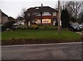
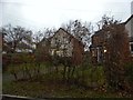
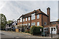
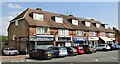
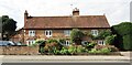
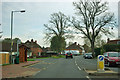
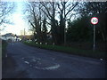
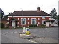
Photos of KT22 9LT


Area Information
KT22 9LT is a small residential postcode area in England, home to 1,267 residents. It is a compact cluster of properties, predominantly houses, with a strong sense of community. The area’s population is largely composed of adults aged 30–64, reflecting a mature demographic with a median age of 47. Daily life here is characterised by proximity to essential services, including retail outlets and rail networks. The postcode is well-served by nearby amenities such as Sainsburys Fetcham and Leatherhead Railway Station, making it convenient for commuters and shoppers. With low flood risk and a crime score of 91, the area offers a safe and stable environment. Its small size means residents are likely to know their neighbours, fostering a close-knit community. The area’s appeal lies in its balance of practicality and tranquillity, with minimal environmental constraints and strong digital connectivity. For those seeking a residential area with low risk and accessible infrastructure, KT22 9LT provides a straightforward, reliable option.
- Area Type
- Postcode
- Area Size
- Not available
- Population
- 1267
- Population Density
- 2140 people/km²
The property market in KT22 9LT is dominated by owner-occupied homes, with 94% of properties owned by residents rather than rented. This high home ownership rate suggests a community of long-term residents, which can contribute to a stable and cohesive neighbourhood. The area’s housing stock is primarily composed of houses, rather than flats or apartments, reflecting a traditional, family-oriented layout. Given the small size of the postcode area, the housing options are limited, and buyers may need to consider nearby areas for more choices. The focus on owner-occupied properties means the market is less influenced by rental demand, which can be advantageous for those seeking a place to settle permanently. The proximity to amenities such as rail stations and retail outlets adds practical value, making KT22 9LT a viable option for those prioritising convenience and security in their property purchase.
House Prices in KT22 9LT
No properties found in this postcode.
Energy Efficiency in KT22 9LT
The lifestyle in KT22 9LT is shaped by its proximity to retail and transport hubs. Nearby amenities include Sainsburys Fetcham, Lidl Leatherhead, and Spar, offering a range of shopping and convenience options. These stores cater to daily needs, from groceries to household essentials, reducing the necessity for long journeys. The area’s rail network, with stations such as Leatherhead and Cobham & Stoke d’Abernon, provides easy access to wider regional services, enhancing both social and professional opportunities. While the data does not mention parks or leisure facilities, the presence of retail and transport links suggests a practical, community-focused lifestyle. Residents can enjoy a balance of convenience and accessibility, with the area’s small size ensuring a sense of familiarity and ease in navigating local amenities.
Amenities
Schools
The nearest school to KT22 9LT is Oakfield Junior School, a primary school with an Ofsted rating of ‘good’. This provides families with a locally available option for early education, though secondary schooling would require travel to nearby towns. The presence of a primary school with a positive rating suggests a commitment to educational quality in the area. However, the data does not include secondary schools, meaning parents may need to look beyond KT22 9LT for comprehensive schooling. The school’s ‘good’ rating indicates it meets national standards, but the absence of further educational facilities highlights a potential limitation for families requiring full-time schooling within the area. This should be considered alongside the broader regional school network when evaluating the area’s suitability for families.
| Rank | School | Type | Entry gender | Ages |
|---|
Explore more schools in this area
Go to Schools tabDemographics
The community in KT22 9LT is predominantly composed of adults aged 30–64, with a median age of 47. Home ownership is exceptionally high at 94%, indicating a stable, long-term resident base. The area is primarily made up of houses, reflecting a traditional housing stock. The predominant ethnic group is White, which aligns with broader regional patterns. The population size of 1,267 suggests a tightly knit neighbourhood where social connections are likely to be strong. The age profile suggests a mature demographic, which may influence local services and amenities. The high home ownership rate implies limited rental properties, making the area more attractive to buyers seeking long-term stability. The absence of significant deprivation data means the area’s quality of life is likely supported by its low risk factors and accessible infrastructure.
Household Size
Accommodation Type
Tenure
Ethnic Group
Religion
Household Composition
Age
Household Deprivation
NS-SEC
Explore more demographic insights in this area
Go to Demographics tabPlanning
Planning Constraints
- Flood RiskPremium
- Ramsar Wetland SitesPremium
- Area of Outstanding Natural BeautyPremium
- Protected Nature ReservePremium
- Protected WoodlandPremium