Area Overview for KT22 9HD
Photos of KT22 9HD
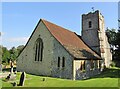
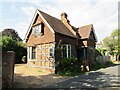
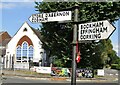

44 photos from this area
Area Information
Key information about the KT22 9HD including its size, population, and administrative classification.
- Area Type
- Postcode
- Area Size
- 2.7 hectares
- Population
- 2147
- Population Density
- 607 people/km²
House Prices in KT22 9HD
34
Properties
£868,900
Average Sold Price
£492,000
Lowest Price
£1,217,500
Highest Price
Showing 34 properties
| Address | Type | Beds | Baths | Last Sale Price | Last Sale Date | |
|---|---|---|---|---|---|---|
| 57 Lower Road, Fetcham, KT22 9HD | Detached | 4 | 2 | £1,217,500 | Oct 2023 | |
| 59 Lower Road, Fetcham, KT22 9HD | Detached | 4 | 2 | £955,000 | Aug 2020 | |
| 65 Lower Road, Fetcham, KT22 9HD | house | 5 | - | £925,000 | Nov 2010 | |
| 61 Lower Road, Fetcham, KT22 9HD | Detached | - | - | £755,000 | Apr 2008 | |
| 63 Lower Road, Fetcham, KT22 9HD | Detached | 3 | 2 | £492,000 | Feb 2006 | |
| Blacktower Financial Management Ltd, Fetcham Park House, Lower Road, Fetcham, KT22 9HD | Office | - | - | - | - | |
| Coastline Produce, Fetcham Park House, Lower Road, Fetcham, KT22 9HD | Office | - | - | - | - | |
| Room 207, Fetcham Park House, Lower Road, Fetcham, KT22 9HD | Office | - | - | - | - | |
| Room 101, Fetcham Park House, Lower Road, Fetcham, KT22 9HD | Office | - | - | - | - | |
| Room 102, Fetcham Park House, Lower Road, Fetcham, KT22 9HD | Office | - | - | - | - |
Page 1 of 4
Energy Efficiency in KT22 9HD
Amenities
Schools
| Rank | School | Type | Entry gender | Ages |
|---|
Explore more schools in this area
Go to Schools tabDemographics
Household Size
Two person
most common
Accommodation Type
Houses
most common
Tenure
95
majority
Ethnic Group
White
most common
Religion
N/A
most common
Household Composition
N/A
most common
Age
47
median
Adults (30-64 years)
most common
Household Deprivation
N/A
with no deprivation
NS-SEC
55
in Lower managerial occupations
Explore more demographic insights in this area
Go to Demographics tabPlanning
Planning Constraints
- Flood RiskPremium
- Ramsar Wetland SitesPremium
- Area of Outstanding Natural BeautyPremium
- Protected Nature ReservePremium
- Protected WoodlandPremium