Area Overview for KT22 9BW
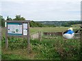
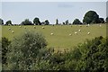
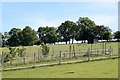
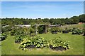
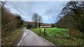
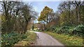
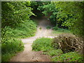
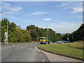
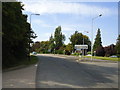
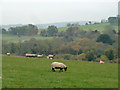
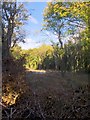
Photos of KT22 9BW

Area Information
KT22 9BW represents a tightly defined residential cluster within England, encompassing just 5,438 square metres of land. This compact footprint supports a population of 2,147 people, creating a neighbourhood where every street corner likely knows another. You are looking at an area with high land-use efficiency, where significant numbers of homes occupy a very small geographic space. Daily life here involves navigating a dense concentration of households that stretch into early adulthood and beyond. The proximity of residents to one another fosters a close-knit community atmosphere typical of such dense postcode areas. When you consider homes in KT22 9BW, you are selecting from a location that prioritises personal space and quiet living over expansive hinterlands. The area functions as a self-contained pocket of suburban England, offering stability and familiarity for those who value a settled environment.
- Area Type
- Postcode
- Area Size
- 5438 m²
- Population
- 2147
- Population Density
- 607 people/km²
This postcode area displays classic characteristics of a long-established, owner-occupied community. The home ownership rate reaches an impressive 95 per cent, signalling a market almost entirely dominated by those who have purchased their own homes. You should not expect to find open-plan newbuilds or purpose-built rental apartments here. Instead, the housing stock consists primarily of houses suitable for family living and retirement. This density of home ownership means that supply for short-term tenants is virtually non-existent within the immediate bounds of KT22 9BW. When searching for homes in this area, you are competing for a specialised pool of properties where previous owners have invested in the upkeep and improvement of their private residences. The market reflects stability, with buyers looking to join an established community rather than enter a transient rental sector.
House Prices in KT22 9BW
Showing 5 properties
| Address | Type | Beds | Baths | Last Sale Price | Last Sale Date | |
|---|---|---|---|---|---|---|
| Hillside, Guildford Road, Fetcham, KT22 9BW | house | 5 | - | £1,194,000 | Feb 2022 | |
| Dalmuir, Guildford Road, Fetcham, KT22 9BW | house | - | - | £700,000 | Feb 2017 | |
| Redleaf House, Guildford Road, Fetcham, KT22 9BW | Detached | 5 | 3 | £870,000 | Mar 2012 | |
| Orchard End, Guildford Road, Fetcham, KT22 9BW | Detached | 4 | 2 | - | - | |
| Ridgelea, Guildford Road, Fetcham, KT22 9BW | house | 5 | - | - | - |
Energy Efficiency in KT22 9BW
Residents of KT22 9BW benefit from practical proximity to key commercial and travel hubs. Five retail locations sit within comfortable reach, including a Spar convenience store, Tesco Bookham, and Co-op High. These venues form the backbone of daily errands, offering groceries and essentials without a lengthy journey. Travel connections are equally convenient, with five rail options nearby. You can walk to Leatherhead Railway Station, Bookham Railway Station, or Box Hill & Westhumble Railway Station. These stations provide direct links to the wider network, allowing you to commute to London or neighbouring boroughs with ease. The combination of five nearby shops and five nearby train stations means you do not need a car for all essential trips. Living in KT22 9BW offers a lifestyle that balances suburban tranquility with the accessibility of major transport arteries and daily shopping requirements.
Amenities
Schools
| Rank | School | Type | Entry gender | Ages |
|---|
Explore more schools in this area
Go to Schools tabDemographics
The community in KT22 9BW is defined by a population with a median age of 47 years. You will find that most homebuyers and residents fall into the 30 to 64 years age range, indicating a mature demographic seeking stability. This area is almost entirely owner-occupied, with a home ownership rate standing at 95 per cent. Long-term residents remain in their properties, suggesting deep local roots and low turnover. Almost all accommodation types consist of houses, meaning you will not find any flats or high-rise blocks within this specific postcode boundary. The predominant ethnic group is White, which contributes to a culturally homogenous environment. With 95 per cent of residents owning their homes, rental seekers seldom find listings here. Instead, those living in KT22 9BW enjoy the peace and quiet that comes with established neighbourhoods and predictable community structures.
Household Size
Accommodation Type
Tenure
Ethnic Group
Religion
Household Composition
Age
Household Deprivation
NS-SEC
Explore more demographic insights in this area
Go to Demographics tabPlanning
Planning Constraints
- Flood RiskPremium
- Ramsar Wetland SitesPremium
- Area of Outstanding Natural BeautyPremium
- Protected Nature ReservePremium
- Protected WoodlandPremium